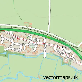
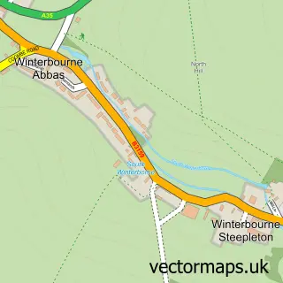
This Grimstone street map is a detailed vector street map covering a 750m x 750m area. Select a larger area to create and download your own vector street map of Grimstone.
The 750-metre map sample for Grimstone covers 30 mapped buildings and approximately 6.7 km of road detail, of which 1 named road are named. The immediate area includes 2 MOT stations within 2 miles. The wider area around Grimstone features 1 hotel. To create a larger or custom map of Grimstone, the map builder lets you define your own coverage area and download editable SVG, PDF and PNG files.
Create a larger editable map of Grimstone
Choose any area you need and generate a high-quality vector map instantly. Perfect for print, planning, design, business and personal use.

This Grimstone street map in Dorset is available as downloadable SVG, PDF and PNG map files, or as a printed map for planning, business, display, education, local information and design work. You can also create a larger custom map area using the map selector.
What this Grimstone map sample shows
Grimstone lies within Stratton Cp parish, part of Charminster St Mary's ward in the Dorset local authority area. The postcode geography for this area includes the DT postcode area, the DT2 postcode district and the DT2 9 postcode sector. Residents fall under the Nhs Dorset Integrated Care Board for NHS services.
Local features near Grimstone
Within 2 milesAmenities and services in and around Grimstone.
Administrative and postcode information for Grimstone
The local authority covering Grimstone is Dorset, within the county of Dorset. The settlement lies within Charminster St Mary's ward and Stratton Cp civil parish. The DT2 postcode district and DT2 9 postcode sector serve the immediate area. NHS provision in the area is delivered through Dorset County Hospital Nhs Foundation Trust.
Nearby street map samples around Grimstone
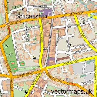

More street maps in Dorset
750 metre map area coverage
Boundary, postcode and point of interest information for the 750m x 750m rectangle centred on this sample map.
Boundaries containing map centre
Constituency: West Dorset Co Const
District: Dorset
Icb: NHS Dorset ICB
Parish: Stratton CP
Police Force: dorset
Postcode District: DT2
Postcode Sector: DT2 9
Ward: Charminster St. Mary's Ward
Nearby boundaries intersecting sample
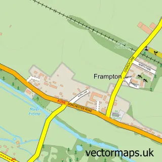
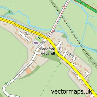
Parish: Bradford Peverell CP, Frampton CP
Postcode coverage
POI category counts
Butcher Shop: 2
Bakery: 1
Bed And Breakfast: 1
Bridge: 1
Elementary School: 1
Hotel: 1
Plumbing: 1
Train Station: 1
Sample points of interest
- Manor Foods
- Royal Yeoman Bb
- Grimstone Viaduct
- Colin Clark & Sons
- Little Angus Butchers
- Manor Foods
- Tudor Cottage Bed & Breakfast
- Whites PHS
- Grimstone and Frampton railway station
Create a larger editable map of Grimstone
This sample shows only a 750 metre area. To create a larger map of Grimstone, use our map builder to choose your own coverage area, add titles and download editable SVG, PDF and PNG files.
Create a custom map of Grimstone