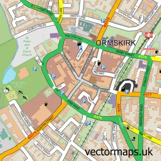
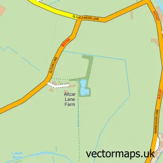
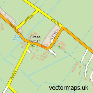
This Halsall street map is a detailed vector street map covering a 750m x 750m area. Select a larger area to create and download your own vector street map of Halsall.
The 750-metre map sample for Halsall covers 101 mapped buildings and approximately 6.8 km of road detail, of which 10 named roads are named. The immediate area includes 1 school and 2 MOT stations within 2 miles. To create a larger or custom map of Halsall, the map builder lets you define your own coverage area and download editable SVG, PDF and PNG files.
Create a larger editable map of Halsall
Choose any area you need and generate a high-quality vector map instantly. Perfect for print, planning, design, business and personal use.

This Halsall street map in Lancashire is available as downloadable SVG, PDF and PNG map files, or as a printed map for planning, business, display, education, local information and design work. You can also create a larger custom map area using the map selector.
What this Halsall map sample shows
Halsall lies within Halsall Cp parish, part of Halsall ward in the West Lancashire District (B) local authority area. The postcode geography for this area includes the L postcode area, the L39 postcode district and the L39 8 postcode sector. Residents fall under the Nhs Lancashire And South Cumbria Integrated Care Board for NHS services.
Local features near Halsall
Within 2 milesAmenities and services in and around Halsall.
Administrative and postcode information for Halsall
Halsall lies within Halsall Cp parish, part of Halsall ward in the West Lancashire District (B) local authority area. The postcode geography for this area includes the L postcode area, the L39 postcode district and the L39 8 postcode sector. Residents fall under the Nhs Lancashire And South Cumbria Integrated Care Board for NHS services.
Nearby street map samples around Halsall

More street maps in Lancashire
750 metre map area coverage
Boundary, postcode and point of interest information for the 750m x 750m rectangle centred on this sample map.
Boundaries containing map centre
Constituency: West Lancashire Co Const
County: Lancashire County
District: West Lancashire District (B)
Icb: NHS Lancashire and South Cumbria ICB
Parish: Halsall CP
Police Force: lancashire
Postcode District: L39
Postcode Sector: L39 8
Ward: Rural West Ward
Nearby boundaries intersecting sample
No additional intersecting boundaries found.
Postcode coverage
POI category counts
Beauty Salon: 2
Church Cathedral: 2
Real Estate Agent: 2
Amateur Sports Team: 1
Anglican Church: 1
Beverage Store: 1
Community Center: 1
Elementary School: 1
Energy Equipment And Solution: 1
Financial Advising: 1
Sample points of interest
- Halsall West End Cricket Club
- St. Cuthbert's
- Marshmallow Kids Salon and Spa
- Walnut Salons
- Eurofood Partners
- St Cuthbert's Church
- St. Thomas’ and St. Cuthbert’s
- Halsall War Memorial Playing Field & Hall Trust
- Halsall Primary School
- Bsolar
- Richard Bamber & Co
- True Potential Wealth Management
Create a larger editable map of Halsall
This sample shows only a 750 metre area. To create a larger map of Halsall, use our map builder to choose your own coverage area, add titles and download editable SVG, PDF and PNG files.
Create a custom map of Halsall