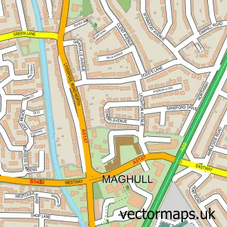
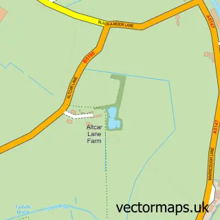
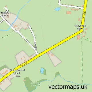
This Aughton street map is a detailed vector street map covering a 750m x 750m area. Select a larger area to create and download your own vector street map of Aughton.
The 750-metre map sample for Aughton covers 69 mapped buildings and approximately 7.9 km of road detail, of which 8 named roads are named. The immediate area includes 2 GP surgeries within 2 miles, 2 pubs and 2 MOT stations within 2 miles. The wider area around Aughton features 2 food and drink venues. To create a larger or custom map of Aughton, the map builder lets you define your own coverage area and download editable SVG, PDF and PNG files.
Create a larger editable map of Aughton
Choose any area you need and generate a high-quality vector map instantly. Perfect for print, planning, design, business and personal use.

This Aughton street map in Lancashire is available as downloadable SVG, PDF and PNG map files, or as a printed map for planning, business, display, education, local information and design work. You can also create a larger custom map area using the map selector.
What this Aughton map sample shows
Aughton lies within Aughton Cp parish, part of Aughton And Downholland ward in the West Lancashire District (B) local authority area. The postcode geography for this area includes the L postcode area, the L39 postcode district and the L39 6 postcode sector. Residents fall under the Nhs Lancashire And South Cumbria Integrated Care Board for NHS services.
Local features near Aughton
Within 2 milesAmenities and services in and around Aughton.
Administrative and postcode information for Aughton
Aughton lies within Aughton Cp parish, part of Aughton And Downholland ward in the West Lancashire District (B) local authority area. The postcode geography for this area includes the L postcode area, the L39 postcode district and the L39 6 postcode sector. Residents fall under the Nhs Lancashire And South Cumbria Integrated Care Board for NHS services.
Nearby street map samples around Aughton

More street maps in Lancashire
750 metre map area coverage
Boundary, postcode and point of interest information for the 750m x 750m rectangle centred on this sample map.
Boundaries containing map centre
Constituency: West Lancashire Co Const
County: Lancashire County
District: West Lancashire District (B)
Icb: NHS Lancashire and South Cumbria ICB
Parish: Aughton CP
Police Force: lancashire
Postcode District: L39
Postcode Sector: L39 6
Ward: Rural South Ward
Nearby boundaries intersecting sample
Postcode Sector: L39 7
Postcode coverage
POI category counts
Church Cathedral: 2
Pub: 2
Anglican Church: 1
Glass And Mirror Sales Service: 1
Landscaping: 1
Lodge: 1
Musical Instrument Store: 1
Real Estate Agent: 1
Scout Hall: 1
Sample points of interest
- St Michael, Aughton
- Grade I listed churches in Lancashire
- St Michael's Church
- Hilton Peacock Stained Glass
- Aughton Green Landscapes
- Woodland Lakes Holiday Lodges
- Christine Clayton Music Tuition
- Stanley Arms
- The Stanley Arms
- Regiment Support Service
- 40th Ormskirk (Aughton St Michaels)
Create a larger editable map of Aughton
This sample shows only a 750 metre area. To create a larger map of Aughton, use our map builder to choose your own coverage area, add titles and download editable SVG, PDF and PNG files.
Create a custom map of Aughton