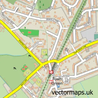
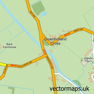
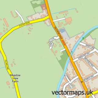
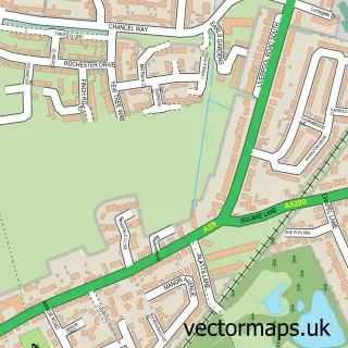
This Ormskirk street map is a detailed vector street map covering a 750m x 750m area. Select a larger area to create and download your own vector street map of Ormskirk.
The 750-metre map sample for Ormskirk covers 377 mapped buildings and approximately 19.8 km of road detail, of which 46 named roads are named. The immediate area includes 2 schools, 1 railway station, 3 GP surgeries, with 4 within 2 miles and 17 pubs among other local services. The wider area around Ormskirk features 5 tourism points of interest, 42 food and drink venues and 2 hotels. To create a larger or custom map of Ormskirk, the map builder lets you define your own coverage area and download editable SVG, PDF and PNG files.
Create a larger editable map of Ormskirk
Choose any area you need and generate a high-quality vector map instantly. Perfect for print, planning, design, business and personal use.

This Ormskirk street map in Lancashire is available as downloadable SVG, PDF and PNG map files, or as a printed map for planning, business, display, education, local information and design work. You can also create a larger custom map area using the map selector.
What this Ormskirk map sample shows
Ormskirk lies within Lancashire County parish, part of Scott ward in the West Lancashire District (B) local authority area. The postcode geography for this area includes the L postcode area, the L39 postcode district and the L39 1 postcode sector. Residents fall under the Nhs Lancashire And South Cumbria Integrated Care Board for NHS services.
Local features near Ormskirk
Within 2 milesAmenities and services in and around Ormskirk.
Administrative and postcode information for Ormskirk
The local authority covering Ormskirk is West Lancashire District (B), within the county of Lancashire. The settlement lies within Scott ward and Lancashire County civil parish. The L39 postcode district and L39 1 postcode sector serve the immediate area. NHS provision in the area is delivered through Southport And Ormskirk Hospital Nhs Trust.
Nearby street map samples around Ormskirk

More street maps in Lancashire
750 metre map area coverage
Boundary, postcode and point of interest information for the 750m x 750m rectangle centred on this sample map.
Boundaries containing map centre
Constituency: West Lancashire Co Const
County: Lancashire County
District: West Lancashire District (B)
Icb: NHS Lancashire and South Cumbria ICB
Police Force: lancashire
Postcode District: L39
Postcode Sector: L39 2
Ward: Ormskirk West Ward
Nearby boundaries intersecting sample
Postcode Sector: L39 1, L39 3, L39 4
Ward: Ormskirk East Ward
Postcode coverage
POI category counts
Beauty Salon: 22
Hair Salon: 17
Pub: 17
Dentist: 11
Restaurant: 10
Cafe: 9
Clothing Store: 9
Flowers And Gifts Shop: 9
Gym: 9
Real Estate Agent: 9
Sample points of interest
- Ormskirk Student Accommodation
- Ormskirk Student Properties
- Stockton Students
- Alexander Myerson & Co.
- Hirsch & Co Accountants
- Jvsa
- Myersons Chartered Accountants
- Acufleurhealth
- Ormskirk Acupuncture and Aesthetics
- Adclix Online Marketing
- Brightspark Creative Media
- Yoople
Create a larger editable map of Ormskirk
This sample shows only a 750 metre area. To create a larger map of Ormskirk, use our map builder to choose your own coverage area, add titles and download editable SVG, PDF and PNG files.
Create a custom map of Ormskirk