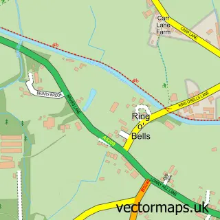
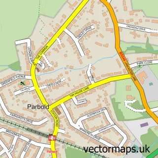
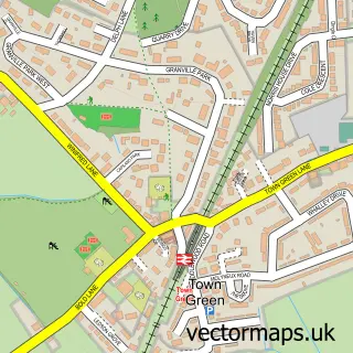
This Burscough street map is a detailed vector street map covering a 750m x 750m area. Select a larger area to create and download your own vector street map of Burscough.
The 750-metre map sample for Burscough covers 481 mapped buildings and approximately 10.0 km of road detail, of which 17 named roads are named. The immediate area includes 1 school, 3 GP surgeries within 2 miles and 6 MOT stations within 2 miles. To create a larger or custom map of Burscough, the map builder lets you define your own coverage area and download editable SVG, PDF and PNG files.
Create a larger editable map of Burscough
Choose any area you need and generate a high-quality vector map instantly. Perfect for print, planning, design, business and personal use.

This Burscough street map in Lancashire is available as downloadable SVG, PDF and PNG map files, or as a printed map for planning, business, display, education, local information and design work. You can also create a larger custom map area using the map selector.
What this Burscough map sample shows
Burscough lies within Burscough Cp parish, part of Burscough West ward in the West Lancashire District (B) local authority area. The postcode geography for this area includes the L postcode area, the L40 postcode district and the L40 7 postcode sector. Residents fall under the Nhs Lancashire And South Cumbria Integrated Care Board for NHS services.
Local features near Burscough
Within 2 milesAmenities and services in and around Burscough.
Administrative and postcode information for Burscough
Burscough lies within Burscough Cp parish, part of Burscough West ward in the West Lancashire District (B) local authority area. The postcode geography for this area includes the L postcode area, the L40 postcode district and the L40 7 postcode sector. Residents fall under the Nhs Lancashire And South Cumbria Integrated Care Board for NHS services.
Nearby street map samples around Burscough

More street maps in Lancashire
750 metre map area coverage
Boundary, postcode and point of interest information for the 750m x 750m rectangle centred on this sample map.
Boundaries containing map centre
Constituency: West Lancashire Co Const
County: Lancashire County
District: West Lancashire District (B)
Icb: NHS Lancashire and South Cumbria ICB
Parish: Burscough CP
Police Force: lancashire
Postcode District: L40
Postcode Sector: L40 7
Ward: Burscough Town Ward
Nearby boundaries intersecting sample
No additional intersecting boundaries found.
Postcode coverage
POI category counts
Bakery: 3
Aquatic Pet Store: 2
Carpenter: 2
Elementary School: 2
Home Developer: 2
Automotive Repair: 1
Bookkeeper: 1
Bridal Shop: 1
Broadcasting Media Production: 1
Carpet Store: 1
Sample points of interest
- Burscough Aquatics
- Burscough Aquatics
- Scotts Automotive Mobile Mechanic
- Little Robin Cakery
- Scruptious Cakes
- Thoroughly-Good Cakes Ltd.
- Tulip Admin Support
- Classic Wedding Cars
- Beaten Track Radio
- Advanced Damp & Timber
- Sauls Joinery
- Burscough Flooring
Create a larger editable map of Burscough
This sample shows only a 750 metre area. To create a larger map of Burscough, use our map builder to choose your own coverage area, add titles and download editable SVG, PDF and PNG files.
Create a custom map of Burscough