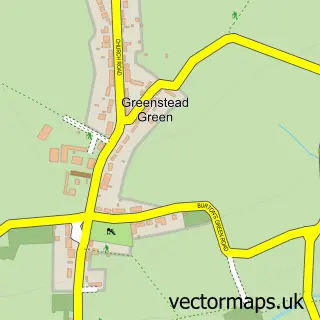
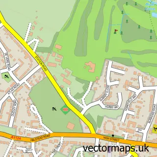
This Halstead street map is a detailed vector street map covering a 750m x 750m area. Select a larger area to create and download your own vector street map of Halstead.
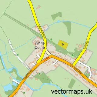
The 750-metre map sample for Halstead covers 484 mapped buildings and approximately 18.6 km of road detail, of which 43 named roads are named. The immediate area includes 1 school, 1 GP surgery, 8 pubs and 1 MOT station, with 4 within 2 miles. The wider area around Halstead features 1 tourism point of interest, 23 food and drink venues and 4 hotels. To create a larger or custom map of Halstead, the map builder lets you define your own coverage area and download editable SVG, PDF and PNG files.
Create a larger editable map of Halstead
Choose any area you need and generate a high-quality vector map instantly. Perfect for print, planning, design, business and personal use.

This Halstead street map in Essex is available as downloadable SVG, PDF and PNG map files, or as a printed map for planning, business, display, education, local information and design work. You can also create a larger custom map area using the map selector.
What this Halstead map sample shows
Halstead lies within Halstead Cp parish, part of Halstead St Andrew's ward in the Braintree District local authority area. The postcode geography for this area includes the CO postcode area, the CO9 postcode district and the CO9 2 postcode sector. Residents fall under the Nhs Mid And South Essex Integrated Care Board for NHS services.
Local features near Halstead
Within 2 milesAmenities and services in and around Halstead.
Administrative and postcode information for Halstead
Halstead lies within Halstead Cp parish, part of Halstead St Andrew's ward in the Braintree District local authority area. The postcode geography for this area includes the CO postcode area, the CO9 postcode district and the CO9 2 postcode sector. Residents fall under the Nhs Mid And South Essex Integrated Care Board for NHS services.
Nearby street map samples around Halstead

More street maps in Essex
750 metre map area coverage
Boundary, postcode and point of interest information for the 750m x 750m rectangle centred on this sample map.
Boundaries containing map centre
Constituency: Braintree Co Const
County: Essex County
District: Braintree District
Icb: NHS Essex ICB
Parish: Halstead CP
Police Force: essex
Postcode District: CO9
Postcode Sector: CO9 2
Ward: Halstead St. Andrew's Ward
Nearby boundaries intersecting sample
Postcode Sector: CO9 1
Ward: Halstead Trinity Ward
Postcode coverage
POI category counts
Barber: 9
Automotive Repair: 8
Beauty Salon: 8
Building Supply Store: 8
Pub: 8
Beauty And Spa: 7
Hair Salon: 7
Indian Restaurant: 7
Real Estate Agent: 7
Cafe: 6
Sample points of interest
- Maurice Lake and Co
- Rupesh Harding Acupuncture
- Leading Edge Graphics
- One Exception
- Halstead: St Andrew
- Halstead Antiques Centre
- Scope Charity Shop
- St Helena Hospice Shop
- Nash Restorations
- Heard Electrics
- Limited Edition Gallery and Framing
- Sconch Yarn Shop
Create a larger editable map of Halstead
This sample shows only a 750 metre area. To create a larger map of Halstead, use our map builder to choose your own coverage area, add titles and download editable SVG, PDF and PNG files.
Create a custom map of Halstead