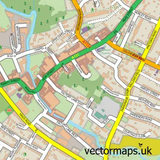
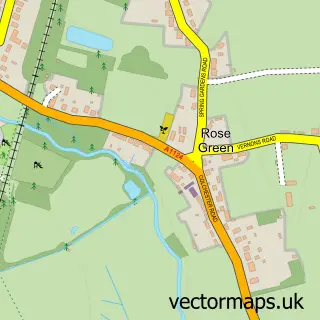
This White Colne street map is a detailed vector street map covering a 750m x 750m area. Select a larger area to create and download your own vector street map of White Colne.
The 750-metre map sample for White Colne covers 152 mapped buildings and approximately 6.6 km of road detail, of which 6 named roads are named. The immediate area includes 1 GP surgery within 2 miles and 3 MOT stations within 2 miles. To create a larger or custom map of White Colne, the map builder lets you define your own coverage area and download editable SVG, PDF and PNG files.
Create a larger editable map of White Colne
Choose any area you need and generate a high-quality vector map instantly. Perfect for print, planning, design, business and personal use.

This White Colne street map in Essex is available as downloadable SVG, PDF and PNG map files, or as a printed map for planning, business, display, education, local information and design work. You can also create a larger custom map area using the map selector.
What this White Colne map sample shows
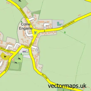
White Colne lies within White Colne Cp parish, part of The Colnes ward in the Braintree District local authority area. The postcode geography for this area includes the CO postcode area, the CO6 postcode district and the CO6 2 postcode sector. Residents fall under the Nhs Mid And South Essex Integrated Care Board for NHS services.
Local features near White Colne
Within 2 milesAmenities and services in and around White Colne.
Administrative and postcode information for White Colne
White Colne lies within White Colne Cp parish, part of The Colnes ward in the Braintree District local authority area. The postcode geography for this area includes the CO postcode area, the CO6 postcode district and the CO6 2 postcode sector. Residents fall under the Nhs Mid And South Essex Integrated Care Board for NHS services.
Nearby street map samples around White Colne


More street maps in Essex
750 metre map area coverage
Boundary, postcode and point of interest information for the 750m x 750m rectangle centred on this sample map.
Boundaries containing map centre
Constituency: Witham Co Const
County: Essex County
District: Braintree District
Icb: NHS Essex ICB
Parish: White Colne CP
Police Force: essex
Postcode District: CO6
Postcode Sector: CO6 2
Ward: The Colnes Ward
Nearby boundaries intersecting sample
Parish: Colne Engaine CP, Earls Colne CP
Postcode coverage
POI category counts
Advertising Agency: 1
Assisted Living Facility: 1
Beauty Salon: 1
Community Center: 1
Electrical Wholesaler: 1
Flowers And Gifts Shop: 1
Gift Shop: 1
Indian Restaurant: 1
Land Surveying: 1
Pilates Studio: 1
Sample points of interest
- CJAM Group
- Chalkney House
- Hair By Collette
- White Colne Village Hall
- Clik Dome Systems
- Passion Flowers by Emma Spowage
- Percivals Fuchsias Hill Farm Enterprises
- Riverside Spice
- Clockworklime - Architectural And Surveying Services
- Posture Pilates
- White Colne Meadows
- Brook House
Create a larger editable map of White Colne
This sample shows only a 750 metre area. To create a larger map of White Colne, use our map builder to choose your own coverage area, add titles and download editable SVG, PDF and PNG files.
Create a custom map of White Colne