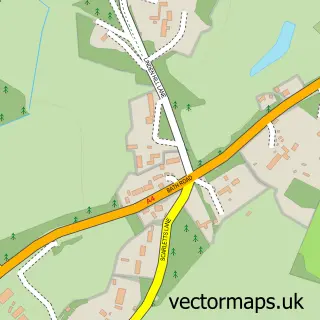
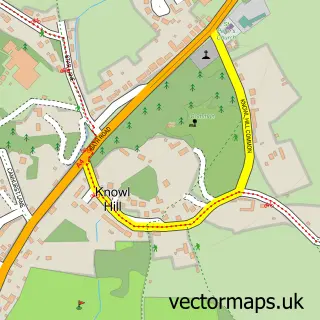
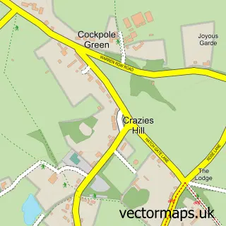
This Hare Hatch street map is a detailed vector street map covering a 750m x 750m area. Select a larger area to create and download your own vector street map of Hare Hatch.
The 750-metre map sample for Hare Hatch covers 118 mapped buildings and approximately 10.1 km of road detail, of which 7 named roads are named. The immediate area includes 2 GP surgeries within 2 miles, 2 pubs and 3 MOT stations within 2 miles. The wider area around Hare Hatch features 1 tourism point of interest and 4 food and drink venues. To create a larger or custom map of Hare Hatch, the map builder lets you define your own coverage area and download editable SVG, PDF and PNG files.
Create a larger editable map of Hare Hatch
Choose any area you need and generate a high-quality vector map instantly. Perfect for print, planning, design, business and personal use.

This Hare Hatch street map in Berkshire is available as downloadable SVG, PDF and PNG map files, or as a printed map for planning, business, display, education, local information and design work. You can also create a larger custom map area using the map selector.
What this Hare Hatch map sample shows
Hare Hatch lies within Wargrave Cp parish, part of Remenham, Wargrave And Ruscombe ward in the Wokingham (B) local authority area. The postcode geography for this area includes the RG postcode area, the RG10 postcode district and the RG10 9 postcode sector. Residents fall under the Nhs Buckinghamshire, Oxfordshire And Berkshire West Integrated Care Board for NHS services.
Local features near Hare Hatch
Within 2 milesAmenities and services in and around Hare Hatch.
Administrative and postcode information for Hare Hatch
Hare Hatch lies within Wargrave Cp parish, part of Remenham, Wargrave And Ruscombe ward in the Wokingham (B) local authority area. The postcode geography for this area includes the RG postcode area, the RG10 postcode district and the RG10 9 postcode sector. Residents fall under the Nhs Buckinghamshire, Oxfordshire And Berkshire West Integrated Care Board for NHS services.
Nearby street map samples around Hare Hatch

More street maps in Berkshire
750 metre map area coverage
Boundary, postcode and point of interest information for the 750m x 750m rectangle centred on this sample map.
Boundaries containing map centre
Constituency: Wokingham Co Const
District: Wokingham (B)
Icb: NHS Thames Valley ICB
Parish: Wargrave CP
Police Force: thames valley
Postcode District: RG10
Postcode Sector: RG10 9
Ward: Thames Ward
Nearby boundaries intersecting sample
No additional intersecting boundaries found.
Postcode coverage
POI category counts
Hot Tubs And Pools: 4
Nursery And Gardening: 4
Retail: 3
Advertising Agency: 2
Aquatic Pet Store: 2
Awning Supplier: 2
Business Manufacturing And Supply: 2
Community Gardens: 2
Corporate Office: 2
Furniture Store: 2
Sample points of interest
- Logos Design Associates Ltd.
- Peppers & Rogers Group
- First for Vintage Antiques Emporium
- Berkshire Garden Machinery
- Maidenhead Aquatics
- Maidenhead Aquatics Hare Hatch
- Arrow Leisure
- GTO Engineering
- Kover-It
- Kover-it
- Sprocket and Gear
- Hotel Reservations Network
Create a larger editable map of Hare Hatch
This sample shows only a 750 metre area. To create a larger map of Hare Hatch, use our map builder to choose your own coverage area, add titles and download editable SVG, PDF and PNG files.
Create a custom map of Hare Hatch