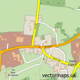
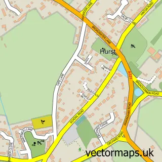
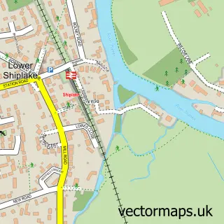
This Ruscombe street map is a detailed vector street map covering a 750m x 750m area. Select a larger area to create and download your own vector street map of Ruscombe.
The 750-metre map sample for Ruscombe covers 324 mapped buildings and approximately 13.0 km of road detail, of which 24 named roads are named. The immediate area includes 2 GP surgeries within 2 miles, 2 pubs and 1 MOT station, with 2 within 2 miles. The wider area around Ruscombe features 1 tourism point of interest and 2 food and drink venues. To create a larger or custom map of Ruscombe, the map builder lets you define your own coverage area and download editable SVG, PDF and PNG files.
Create a larger editable map of Ruscombe
Choose any area you need and generate a high-quality vector map instantly. Perfect for print, planning, design, business and personal use.

This Ruscombe street map in Berkshire is available as downloadable SVG, PDF and PNG map files, or as a printed map for planning, business, display, education, local information and design work. You can also create a larger custom map area using the map selector.
What this Ruscombe map sample shows
Ruscombe lies within Ruscombe Cp parish, part of Remenham, Wargrave And Ruscombe ward in the Wokingham (B) local authority area. The postcode geography for this area includes the RG postcode area, the RG10 postcode district and the RG10 9 postcode sector. Residents fall under the Nhs Buckinghamshire, Oxfordshire And Berkshire West Integrated Care Board for NHS services.
Local features near Ruscombe
Within 2 milesAmenities and services in and around Ruscombe.
Administrative and postcode information for Ruscombe
The local authority covering Ruscombe is Wokingham (B), within the county of Berkshire. The settlement lies within Remenham, Wargrave And Ruscombe ward and Ruscombe Cp civil parish. The RG10 postcode district and RG10 9 postcode sector serve the immediate area. NHS provision in the area is delivered through Royal Berkshire Nhs Foundation Trust.
Nearby street map samples around Ruscombe

More street maps in Berkshire
750 metre map area coverage
Boundary, postcode and point of interest information for the 750m x 750m rectangle centred on this sample map.
Boundaries containing map centre
Constituency: Wokingham Co Const
District: Wokingham (B)
Icb: NHS Thames Valley ICB
Parish: Ruscombe CP
Police Force: thames valley
Postcode District: RG10
Postcode Sector: RG10 9
Ward: Twyford, Ruscombe & Hurst Ward
Nearby boundaries intersecting sample
Parish: Twyford CP
Postcode Sector: RG10 0
Postcode coverage
POI category counts
Information Technology Company: 5
Building Supply Store: 4
Automotive Repair: 2
Interior Design: 2
It Service And Computer Repair: 2
Legal Services: 2
Lighting Fixture Manufacturers: 2
Pub: 2
Anglican Church: 1
Architect: 1
Sample points of interest
- Ruscombe: St. James the Great
- Ruscombe Green
- Bulldog Service Station
- Bulldog Service Station
- Evolution Autoworks
- Moulded Cords and Cables
- Ross Robotics Limited
- Binghams Brewery Ltd.
- JL Bookkeeping Services
- Building Materials Nationwide
- Building Materials Nationwide Ltd.
- Hicks Carpentry
Create a larger editable map of Ruscombe
This sample shows only a 750 metre area. To create a larger map of Ruscombe, use our map builder to choose your own coverage area, add titles and download editable SVG, PDF and PNG files.
Create a custom map of Ruscombe