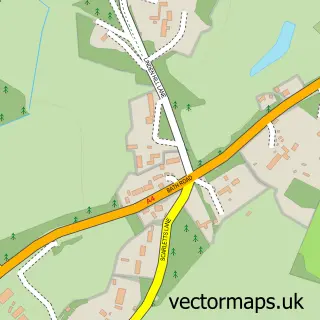
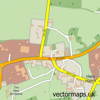
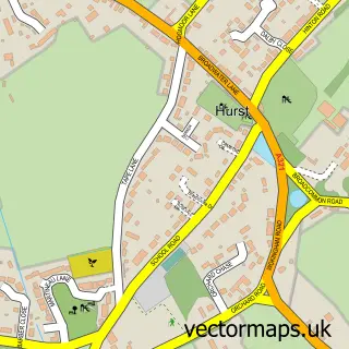
This Waltham St Lawrence street map is a detailed vector street map covering a 750m x 750m area. Select a larger area to create and download your own vector street map of Waltham St Lawrence.
The 750-metre map sample for Waltham St Lawrence covers 157 mapped buildings and approximately 10.0 km of road detail, of which 6 named roads are named. The immediate area includes 1 pub and 3 MOT stations within 2 miles. The wider area around Waltham St Lawrence features 1 food and drink venue. To create a larger or custom map of Waltham St Lawrence, the map builder lets you define your own coverage area and download editable SVG, PDF and PNG files.
Create a larger editable map of Waltham St Lawrence
Choose any area you need and generate a high-quality vector map instantly. Perfect for print, planning, design, business and personal use.

This Waltham St Lawrence street map in Berkshire is available as downloadable SVG, PDF and PNG map files, or as a printed map for planning, business, display, education, local information and design work. You can also create a larger custom map area using the map selector.
What this Waltham St Lawrence map sample shows
Waltham St Lawrence lies within Waltham St. Lawrence Cp parish, part of Hurley & Walthams ward in the Windsor And Maidenhead (B) local authority area. The postcode geography for this area includes the RG postcode area, the RG10 postcode district and the RG10 0 postcode sector. Residents fall under the Nhs Frimley Integrated Care Board for NHS services.
Local features near Waltham St Lawrence
Within 2 milesAmenities and services in and around Waltham St Lawrence.
Administrative and postcode information for Waltham St Lawrence
The local authority covering Waltham St Lawrence is Windsor And Maidenhead (B), within the county of Berkshire. The settlement lies within Hurley & Walthams ward and Waltham St. Lawrence Cp civil parish. The RG10 postcode district and RG10 0 postcode sector serve the immediate area. NHS provision in the area is delivered through Frimley Health Nhs Foundation Trust.
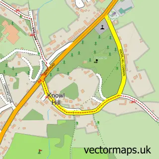
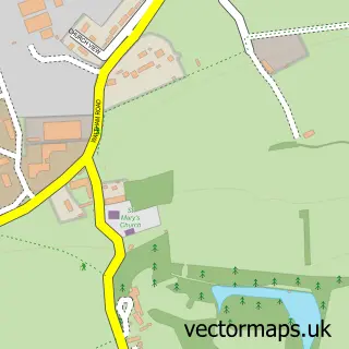
Nearby street map samples around Waltham St Lawrence

More street maps in Berkshire
750 metre map area coverage
Boundary, postcode and point of interest information for the 750m x 750m rectangle centred on this sample map.
Boundaries containing map centre
Constituency: Maidenhead Co Const
District: Windsor and Maidenhead (B)
Icb: NHS Frimley ICB
Parish: Waltham St. Lawrence CP
Police Force: thames valley
Postcode District: RG10
Postcode Sector: RG10 0
Ward: Hurley & Walthams Ward
Nearby boundaries intersecting sample
No additional intersecting boundaries found.
Postcode coverage
POI category counts
Car Dealer: 2
Alternative Medicine: 1
Anglican Church: 1
Auction House: 1
Church Cathedral: 1
Community Center: 1
Gym: 1
It Service And Computer Repair: 1
Landscaping: 1
Lawyer: 1
Sample points of interest
- Peter Bartlett
- Parish Church of St Lawrence
- Simpsons Auctions
- Driven Car Collection
- Hedinghams
- Waltham St Lawrence Parish Church
- Neville Hall
- Rowing Solutions Ltd.
- Accordis
- Harper Landscapes
- Philp David and Partners
- PLFM
Create a larger editable map of Waltham St Lawrence
This sample shows only a 750 metre area. To create a larger map of Waltham St Lawrence, use our map builder to choose your own coverage area, add titles and download editable SVG, PDF and PNG files.
Create a custom map of Waltham St Lawrence