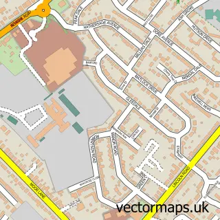
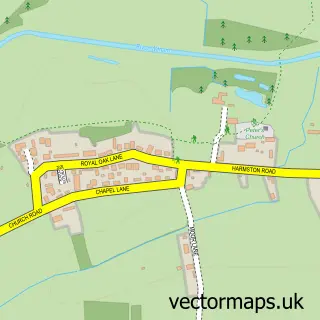
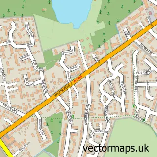
This Harmston street map is a detailed vector street map covering a 750m x 750m area. Select a larger area to create and download your own vector street map of Harmston.
The 750-metre map sample for Harmston covers 255 mapped buildings and approximately 14.5 km of road detail, of which 15 named roads are named. The immediate area includes 1 pub and 1 MOT station within 2 miles. The wider area around Harmston features 1 food and drink venue. To create a larger or custom map of Harmston, the map builder lets you define your own coverage area and download editable SVG, PDF and PNG files.
Create a larger editable map of Harmston
Choose any area you need and generate a high-quality vector map instantly. Perfect for print, planning, design, business and personal use.

This Harmston street map in Lincolnshire is available as downloadable SVG, PDF and PNG map files, or as a printed map for planning, business, display, education, local information and design work. You can also create a larger custom map area using the map selector.
What this Harmston map sample shows
Harmston lies within Harmston Cp parish, part of Cliff Villages ward in the North Kesteven District local authority area. The postcode geography for this area includes the LN postcode area, the LN5 postcode district and the LN5 9 postcode sector. Residents fall under the Nhs Lincolnshire Integrated Care Board for NHS services.
Local features near Harmston
Within 2 milesAmenities and services in and around Harmston.
Administrative and postcode information for Harmston
Harmston lies within Harmston Cp parish, part of Cliff Villages ward in the North Kesteven District local authority area. The postcode geography for this area includes the LN postcode area, the LN5 postcode district and the LN5 9 postcode sector. Residents fall under the Nhs Lincolnshire Integrated Care Board for NHS services.
Nearby street map samples around Harmston

More street maps in Lincolnshire
750 metre map area coverage
Boundary, postcode and point of interest information for the 750m x 750m rectangle centred on this sample map.
Boundaries containing map centre
Constituency: Sleaford and North Hykeham Co Const
County: Lincolnshire County
District: North Kesteven District
Icb: NHS Lincolnshire ICB
Parish: Harmston CP
Police Force: lincolnshire
Postcode District: LN5
Postcode Sector: LN5 9
Ward: Waddington Rural Ward
Nearby boundaries intersecting sample
No additional intersecting boundaries found.
Postcode coverage
POI category counts
Alternative Medicine: 2
Taxi Service: 2
Anglican Church: 1
Auto Electrical Repair: 1
Building Supply Store: 1
Dance School: 1
Pet Groomer: 1
Pub: 1
Topic Concert Venue: 1
Sample points of interest
- Born 2 Be
- Karla Holmes
- All Saints Church, Harmston
- Jim Brian Electrical Services
- A McClelland Plastering
- Hykeham School of Dance
- Hair Of The Dog Harmston
- Thorold Arms
- CABS4LESS Ltd.
- Cabs 4 Less Ltd.
- Harmston Memorial Hall
Create a larger editable map of Harmston
This sample shows only a 750 metre area. To create a larger map of Harmston, use our map builder to choose your own coverage area, add titles and download editable SVG, PDF and PNG files.
Create a custom map of Harmston