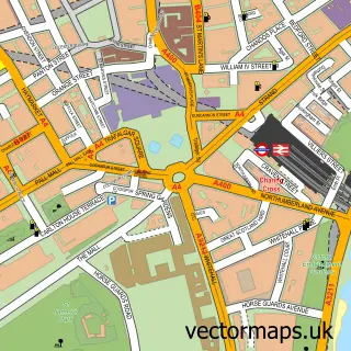
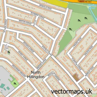
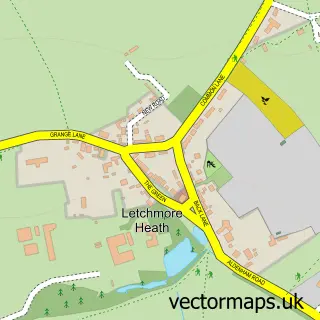
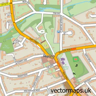
This Harrow street map is a detailed vector street map covering a 750m x 750m area. Select a larger area to create and download your own vector street map of Harrow.
The 750-metre map sample for Harrow covers 269 mapped buildings and approximately 21.4 km of road detail, of which 37 named roads are named. The immediate area includes 2 schools, 1 railway station, 1 GP surgery, with 24 within 2 miles and 13 pubs among other local services. The wider area around Harrow features 6 tourism points of interest, 48 food and drink venues and 10 hotels. To create a larger or custom map of Harrow, the map builder lets you define your own coverage area and download editable SVG, PDF and PNG files.
Create a larger editable map of Harrow
Choose any area you need and generate a high-quality vector map instantly. Perfect for print, planning, design, business and personal use.

This Harrow street map in Greater London is available as downloadable SVG, PDF and PNG map files, or as a printed map for planning, business, display, education, local information and design work. You can also create a larger custom map area using the map selector.
What this Harrow map sample shows
Harrow lies within Greater London Authority parish, part of Greenhill ward in the Harrow London Boro local authority area. The postcode geography for this area includes the HA postcode area, the HA1 postcode district and the HA1 2 postcode sector. Residents fall under the Nhs North West London Integrated Care Board for NHS services.
Local features near Harrow
Within 2 milesAmenities and services in and around Harrow.
Administrative and postcode information for Harrow
Harrow lies within Greater London Authority parish, part of Greenhill ward in the Harrow London Boro local authority area. The postcode geography for this area includes the HA postcode area, the HA1 postcode district and the HA1 2 postcode sector. Residents fall under the Nhs North West London Integrated Care Board for NHS services.
Nearby street map samples around Harrow

More street maps in Greater London
750 metre map area coverage
Boundary, postcode and point of interest information for the 750m x 750m rectangle centred on this sample map.
Boundaries containing map centre
Constituency: Harrow West Boro Const
County: Greater London Authority
District: Harrow London Boro
Icb: NHS West and North London IC
Police Force: metropolitan
Postcode District: HA1
Postcode Sector: HA1 1
Ward: Greenhill Ward
Nearby boundaries intersecting sample
Postcode Sector: HA1 2, HA1 3, HA1 4
Ward: Harrow on the Hill Ward, Headstone Ward, Marlborough Ward, West Harrow Ward
Postcode coverage
POI category counts
Accountant: 39
Employment Agencies: 31
Professional Services: 31
Hair Salon: 20
Clothing Store: 19
Financial Service: 17
Beauty Salon: 16
Real Estate Agent: 16
Coffee Shop: 15
Home Health Care: 15
Sample points of interest
- Compare.Rehab
- A & S Consultants Ltd.
- A J Shah & Co
- Alan Solomons & Co
- Alliotts
- Alpha Partnership
- Ayman Tyler Associates
- Azuki Accounts Limited
- Bubble Accountancy
- Charles Rippin and Turner
- Charterhouse - Accountants Limited
- Charterhouse Accountants LLP
Create a larger editable map of Harrow
This sample shows only a 750 metre area. To create a larger map of Harrow, use our map builder to choose your own coverage area, add titles and download editable SVG, PDF and PNG files.
Create a custom map of Harrow