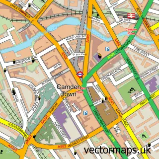
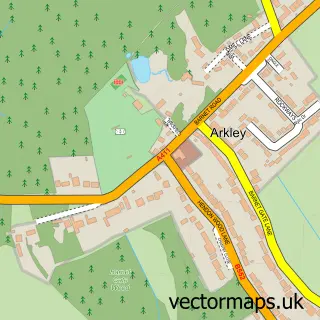
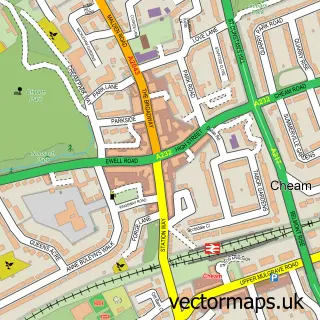
This London street map is a detailed vector street map covering a 750m x 750m area. Select a larger area to create and download your own vector street map of London.
The 750-metre map sample for London covers 84 mapped buildings and approximately 23.7 km of road detail, of which 68 named roads are named. The immediate area includes 1 railway station, 45 GP surgeries within 2 miles, 48 pubs and 11 MOT stations within 2 miles. The wider area around London features 99 tourism points of interest, 194 food and drink venues and 62 hotels. To create a larger or custom map of London, the map builder lets you define your own coverage area and download editable SVG, PDF and PNG files.
Create a larger editable map of London
Choose any area you need and generate a high-quality vector map instantly. Perfect for print, planning, design, business and personal use.

This London street map in Greater London is available as downloadable SVG, PDF and PNG map files, or as a printed map for planning, business, display, education, local information and design work. You can also create a larger custom map area using the map selector.
What this London map sample shows
London lies within Greater London Authority parish, part of Castle Baynard ward in the City And County Of The City Of London local authority area. Residents fall under the Nhs North East London Integrated Care Board for NHS services.
Local features near London
Within 2 milesAmenities and services in and around London.
Administrative and postcode information for London
London lies within Greater London Authority parish, part of Castle Baynard ward in the City And County Of The City Of London local authority area. Residents fall under the Nhs North East London Integrated Care Board for NHS services.
Nearby street map samples around London

More street maps in Greater London

750 metre map area coverage
Boundary, postcode and point of interest information for the 750m x 750m rectangle centred on this sample map.
Boundaries containing map centre
Constituency: Cities of London and Westminster Boro Const
County: Greater London Authority
District: City of Westminster London Boro
Icb: NHS West and North London IC
Police Force: metropolitan
Postcode District: WC2N
Postcode Sector: WC2N 5
Ward: St. James's Ward
Nearby boundaries intersecting sample
Postcode District: SW1A, SW1Y, W1D, WC2E, WC2H, WC2R
Postcode Sector: SW1A 2, SW1Y 4, SW1Y 5, W1D 4, W1D 6, W1D 7
Ward: West End Ward
Postcode coverage
POI category counts
Professional Services: 102
Restaurant: 70
Hotel: 62
Financial Service: 56
Landmark And Historical Building: 52
Community Services Non Profits: 51
Bar: 49
Pub: 49
Theatre: 42
Coffee Shop: 40
Sample points of interest
- Addiction Advocates
- Arcore Premium Rental the Strand
- Buckingham Arcade
- LSE Gospel Society
- Northumberland House
- Studio Apartment, Covent Garden
- 2E Accountants
- ACCA
- Bambridge Accountants
- Bourner Bullock
- Calder & Co
- DFK International
Create a larger editable map of London
This sample shows only a 750 metre area. To create a larger map of London, use our map builder to choose your own coverage area, add titles and download editable SVG, PDF and PNG files.
Create a custom map of London