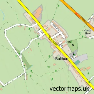
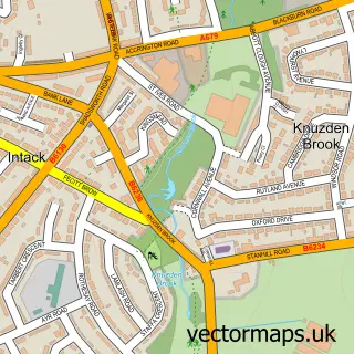
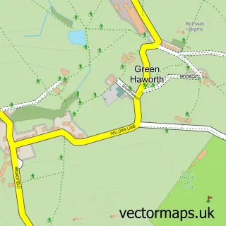
This Hoddlesden street map is a detailed vector street map covering a 750m x 750m area. Select a larger area to create and download your own vector street map of Hoddlesden.
The 750-metre map sample for Hoddlesden covers 248 mapped buildings and approximately 14.0 km of road detail, of which 25 named roads are named. The immediate area includes 1 school, 3 GP surgeries within 2 miles, 1 pub and 1 MOT station, with 9 within 2 miles. The wider area around Hoddlesden features 1 tourism point of interest and 1 food and drink venue. To create a larger or custom map of Hoddlesden, the map builder lets you define your own coverage area and download editable SVG, PDF and PNG files.
Create a larger editable map of Hoddlesden
Choose any area you need and generate a high-quality vector map instantly. Perfect for print, planning, design, business and personal use.

This Hoddlesden street map in Lancashire is available as downloadable SVG, PDF and PNG map files, or as a printed map for planning, business, display, education, local information and design work. You can also create a larger custom map area using the map selector.
What this Hoddlesden map sample shows
Hoddlesden lies within Blackburn With Darwen (B) parish, part of West Pennine ward in the Blackburn With Darwen (B) local authority area. The postcode geography for this area includes the BB postcode area, the BB3 postcode district and the BB3 3 postcode sector. Residents fall under the Nhs Lancashire And South Cumbria Integrated Care Board for NHS services.
Local features near Hoddlesden
Within 2 milesAmenities and services in and around Hoddlesden.
Administrative and postcode information for Hoddlesden
The local authority covering Hoddlesden is Blackburn With Darwen (B), within the county of Lancashire. The settlement lies within West Pennine ward and Blackburn With Darwen (B) civil parish. The BB3 postcode district and BB3 3 postcode sector serve the immediate area. NHS provision in the area is delivered through East Lancashire Hospitals Nhs Trust.
Nearby street map samples around Hoddlesden

More street maps in Lancashire

750 metre map area coverage
Boundary, postcode and point of interest information for the 750m x 750m rectangle centred on this sample map.
Boundaries containing map centre
Constituency: Rossendale and Darwen Co Const
District: Blackburn with Darwen (B)
Icb: NHS Lancashire and South Cumbria ICB
Police Force: lancashire
Postcode District: BB3
Postcode Sector: BB3 3
Ward: West Pennine Ward
Nearby boundaries intersecting sample
Parish: Yate and Pickup Bank CP
Postcode coverage
POI category counts
Church Cathedral: 2
Elementary School: 2
Professional Services: 2
Anglican Church: 1
Beauty And Spa: 1
Beauty Salon: 1
Community Center: 1
Convenience Store: 1
Farm: 1
Hair Salon: 1
Sample points of interest
- St Paul's 'Church in the School' Hoddlesden
- Pucker and Brow
- Mollie Jane Beauty
- St Pauls School Hoddlesden
- The Reach, Hoddlesden, BB3 3NN
- Carus Centre
- Hoddlesden Deli and Village Store
- Hoddlesden St Paul's Church of England Primary School
- Hoddlesden St Pauls C Of E Primary School
- Cuckoldman's Farm
- Heavenly Hair
- Hoddlesden Garage
Create a larger editable map of Hoddlesden
This sample shows only a 750 metre area. To create a larger map of Hoddlesden, use our map builder to choose your own coverage area, add titles and download editable SVG, PDF and PNG files.
Create a custom map of Hoddlesden