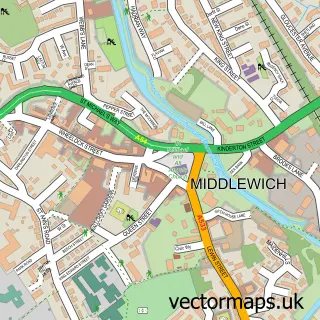
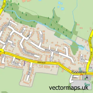
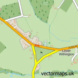
This Holmes Chapel street map is a detailed vector street map covering a 750m x 750m area. Select a larger area to create and download your own vector street map of Holmes Chapel.
The 750-metre map sample for Holmes Chapel covers 554 mapped buildings and approximately 20.2 km of road detail, of which 44 named roads are named. The immediate area includes 1 school, 1 GP surgery, 3 pubs and 1 MOT station, with 3 within 2 miles. The wider area around Holmes Chapel features 3 tourism points of interest and 7 food and drink venues. To create a larger or custom map of Holmes Chapel, the map builder lets you define your own coverage area and download editable SVG, PDF and PNG files.
Create a larger editable map of Holmes Chapel
Choose any area you need and generate a high-quality vector map instantly. Perfect for print, planning, design, business and personal use.

This Holmes Chapel street map in Cheshire is available as downloadable SVG, PDF and PNG map files, or as a printed map for planning, business, display, education, local information and design work. You can also create a larger custom map area using the map selector.
What this Holmes Chapel map sample shows
Holmes Chapel lies within Holmes Chapel Cp parish, part of Dane Valley ward in the Cheshire East (B) local authority area. The postcode geography for this area includes the CW postcode area, the CW4 postcode district and the CW4 8 postcode sector. Residents fall under the Nhs Cheshire And Merseyside Integrated Care Board for NHS services.
Local features near Holmes Chapel
Within 2 milesAmenities and services in and around Holmes Chapel.
Administrative and postcode information for Holmes Chapel
The local authority covering Holmes Chapel is Cheshire East (B), within the county of Cheshire. The settlement lies within Dane Valley ward and Holmes Chapel Cp civil parish. The CW4 postcode district and CW4 8 postcode sector serve the immediate area. NHS provision in the area is delivered through Mid Cheshire Hospitals Nhs Foundation Trust.
Nearby street map samples around Holmes Chapel

More street maps in Cheshire
750 metre map area coverage
Boundary, postcode and point of interest information for the 750m x 750m rectangle centred on this sample map.
Boundaries containing map centre
Constituency: Congleton Co Const
District: Cheshire East (B)
Icb: NHS Cheshire and Merseyside ICB
Parish: Holmes Chapel CP
Police Force: cheshire
Postcode District: CW4
Postcode Sector: CW4 7
Ward: Dane Valley Ward
Nearby boundaries intersecting sample
Postcode Sector: CW4 8
Postcode coverage
POI category counts
Beauty Salon: 8
Real Estate Agent: 7
Barber: 5
Professional Services: 5
Hair Salon: 4
Banks: 3
Beauty And Spa: 3
Building Supply Store: 3
Cafe: 3
Chinese Restaurant: 3
Sample points of interest
- Bennett Design
- Simple PR
- Malpas Tractors
- St Luke's Holmes Chapel
- Sue Ryder
- CLS Care Services Group
- Morrisons Daily - Holmes Chapel
- A B Race & Performance
- Wo-Wo
- S & R Motor Services Ltd.
- Mandevilles Bakery
- W Mandeville Ltd
Create a larger editable map of Holmes Chapel
This sample shows only a 750 metre area. To create a larger map of Holmes Chapel, use our map builder to choose your own coverage area, add titles and download editable SVG, PDF and PNG files.
Create a custom map of Holmes Chapel