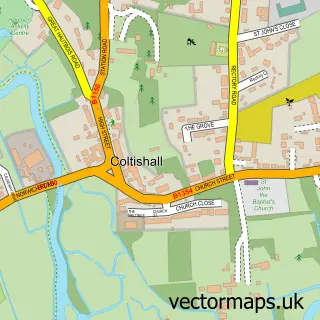
This Hoveton street map is a detailed vector street map covering a 750m x 750m area. Select a larger area to create and download your own vector street map of Hoveton.
The 750-metre map sample for Hoveton covers 373 mapped buildings and approximately 13.2 km of road detail, of which 21 named roads are named. The immediate area includes 1 school, 1 railway station, 1 GP surgery within 2 miles and 2 pubs among other local services. The wider area around Hoveton features 2 tourism points of interest, 17 food and drink venues and 7 hotels. To create a larger or custom map of Hoveton, the map builder lets you define your own coverage area and download editable SVG, PDF and PNG files.
Create a larger editable map of Hoveton
Choose any area you need and generate a high-quality vector map instantly. Perfect for print, planning, design, business and personal use.

This Hoveton street map in Norfolk is available as downloadable SVG, PDF and PNG map files, or as a printed map for planning, business, display, education, local information and design work. You can also create a larger custom map area using the map selector.
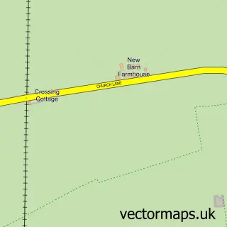
What this Hoveton map sample shows
Hoveton lies within Hoveton Cp parish, part of Hoveton & Tunstead ward in the North Norfolk District local authority area. The postcode geography for this area includes the NR postcode area, the NR12 postcode district and the NR12 8 postcode sector. Residents fall under the Nhs Norfolk And Waveney Integrated Care Board for NHS services.
Local features near Hoveton
Within 2 milesAmenities and services in and around Hoveton.
Administrative and postcode information for Hoveton
The local authority covering Hoveton is North Norfolk District, within the county of Norfolk. The settlement lies within Hoveton & Tunstead ward and Hoveton Cp civil parish. The NR12 postcode district and NR12 8 postcode sector serve the immediate area. NHS provision in the area is delivered through Norfolk And Norwich University Hospitals Nhs Foundation Trust.
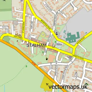
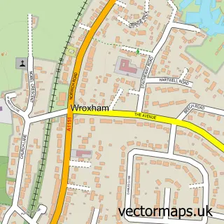
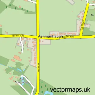
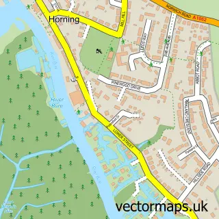
Nearby street map samples around Hoveton

More street maps in Norfolk
750 metre map area coverage
Boundary, postcode and point of interest information for the 750m x 750m rectangle centred on this sample map.
Boundaries containing map centre
Constituency: North Norfolk Co Const
County: Norfolk County
District: North Norfolk District
Icb: NHS Norfolk and Waveney ICB
Parish: Hoveton CP
Police Force: norfolk
Postcode District: NR12
Postcode Sector: NR12 8
Ward: Hoveton & Tunstead Ward
Nearby boundaries intersecting sample
Constituency: Broadland and Fakenham Co Const
District: Broadland District
Parish: Wroxham CP
Ward: Wroxham Ward
Postcode coverage
POI category counts
Restaurant: 9
Boat Rental And Training: 7
Hotel: 7
Banks: 6
Real Estate Agent: 5
Beauty Salon: 4
Coffee Shop: 4
Resort: 4
Automotive Repair: 3
Boat Service And Repair: 3
Sample points of interest
- Debit and Credit Accountancy Services
- Get Fit personal training
- Sue Ryder Care
- Abbotts Estate Agents Wroxham
- Abbotts North
- Norfolk Sketches
- Riverside Art & Glass
- Yim Siam Thai Restaraunt
- Heron Lodge Care Home
- Dragon Security Systems
- Jimmys Mazda Rotary Specialists
- SMT Motors - Hoveton Ltd
Create a larger editable map of Hoveton
This sample shows only a 750 metre area. To create a larger map of Hoveton, use our map builder to choose your own coverage area, add titles and download editable SVG, PDF and PNG files.
Create a custom map of Hoveton