Vector Maps logo
Home Why it works Popular maps Districts Samples Customizer Create Your Map
VectorMaps.uk
Home Popular maps Districts Samples Customizer Create Your Map Privacy Disclaimer
Home / UK Maps / South Yorkshire / Hoyland Map

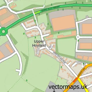
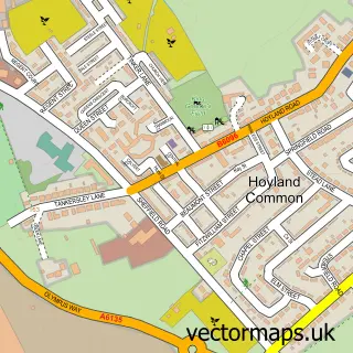
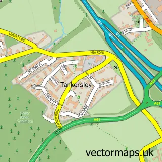
This Hoyland street map is a detailed vector street map covering a 750m x 750m area. Select a larger area to create and download your own vector street map of Hoyland.

Hoyland is a town in South Yorkshire, in the Yorkshire And The Humber of England. Historically, the area formed part of Yorkshire. The settlement falls within the Barnsley East parliamentary constituency. It is served by the S74 postcode district, with S7

The 750-metre map sample for Hoyland covers 681 mapped buildings and approximately 21.5 km of road detail, of which 56 named roads are named. The immediate area includes 2 GP surgeries, 5 pubs and 2 MOT stations, with 9 within 2 miles. The wider area around Hoyland features 10 food and drink venues and 1 hotel. To create a larger or custom map of Hoyland, the map builder lets you define your own coverage area and download editable SVG, PDF and PNG files.

681Buildings
21.46 kmRoads
56Named roads
13,359Residents within 2 miles
Create your own

Create a larger editable map of Hoyland

Choose any area you need and generate a high-quality vector map instantly. Perfect for print, planning, design, business and personal use.

Choose any location
Editable SVG files
Any size up to A0
PDF, PNG & more
Instant download
High quality guaranteed
Create My Custom Map
Secure, private & no credit card required
Hoyland Vector Street Map
750m Sample
Hoyland vector street map sample showing roads, buildings and local features in a 750 metre preview area
Buy Hoyland Map Print from £12.95 Buy Hoyland Digital Map from £6

This Hoyland street map in South Yorkshire is available as downloadable SVG, PDF and PNG map files, or as a printed map for planning, business, display, education, local information and design work. You can also create a larger custom map area using the map selector.

What this Hoyland map sample shows

Hoyland lies within Barnsley District (B) parish, part of Hoyland Milton ward in the Barnsley District (B) local authority area. The postcode geography for this area includes the S postcode area, the S74 postcode district and the S74 0 postcode sector. Residents fall under the Nhs South Yorkshire Integrated Care Board for NHS services.

Local features near Hoyland

Within 2 miles

Amenities and services in and around Hoyland.

2 GP surgeries 2 within 2 miles
2 MOT stations 9 within 2 miles
10 Food & drink
5 Pubs
1 Hotels
9 Healthcare POIs
9 Vehicle services

Counts are approximate and based on publicly available data.

Administrative and postcode information for Hoyland

Hoyland lies within Barnsley District (B) parish, part of Hoyland Milton ward in the Barnsley District (B) local authority area. The postcode geography for this area includes the S postcode area, the S74 postcode district and the S74 0 postcode sector. Residents fall under the Nhs South Yorkshire Integrated Care Board for NHS services.

Parish BARNSLEY DISTRICT (B)
Ward Hoyland Milton
District / local authority Barnsley District (B)
County South Yorkshire
Historic county Yorkshire
Postcode district S74
Postcode sector S74 0
Parliamentary constituency Barnsley East
Region Yorkshire and the Humber
Country England

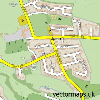
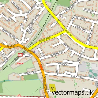
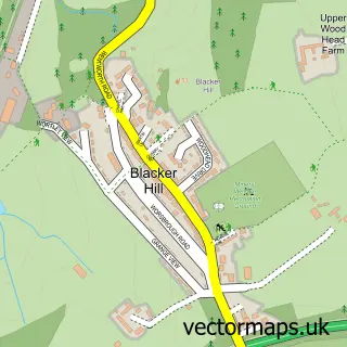
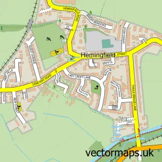
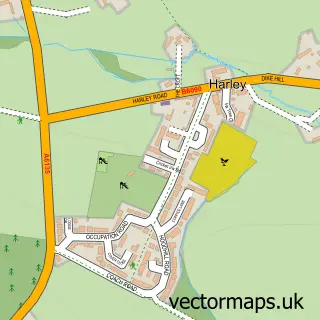
Nearby street map samples around Hoyland

Street map sample of Sheffield, South Yorkshire Sheffield City - South Yorkshire - 8.4 miles Street map sample of Jump, South Yorkshire Jump Village - South Yorkshire - 0.6 miles Street map sample of Elsecar, South Yorkshire Elsecar Village - South Yorkshire - 0.6 miles Street map sample of Upper Hoyland, South Yorkshire Upper Hoyland Village - South Yorkshire - 0.8 miles Street map sample of Blacker Hill, South Yorkshire Blacker Hill Village - South Yorkshire - 1.0 miles Street map sample of Hoyland Common, South Yorkshire Hoyland Common Village - South Yorkshire - 1.1 miles Street map sample of Hemingfield, South Yorkshire Hemingfield Village - South Yorkshire - 1.3 miles Street map sample of Harley, South Yorkshire Harley Village - South Yorkshire - 1.5 miles Street map sample of Wentworth, South Yorkshire Wentworth Village - South Yorkshire - 1.7 miles Street map sample of Tankersley, South Yorkshire Tankersley Village - South Yorkshire - 1.8 miles

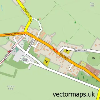
More street maps in South Yorkshire

Street map sample of Jump, South Yorkshire Jump Village - 0.6 miles Street map sample of Elsecar, South Yorkshire Elsecar Village - 0.6 miles Street map sample of Upper Hoyland, South Yorkshire Upper Hoyland Village - 0.8 miles Street map sample of Blacker Hill, South Yorkshire Blacker Hill Village - 1.0 miles Street map sample of Hoyland Common, South Yorkshire Hoyland Common Village - 1.1 miles

750 metre map area coverage

Boundary, postcode and point of interest information for the 750m x 750m rectangle centred on this sample map.

Boundaries containing map centre

Constituency: Barnsley South Co Const

District: Barnsley District (B)

Icb: NHS South Yorkshire ICB

Police Force: south yorkshire

Postcode District: S74

Postcode Sector: S74 9

Ward: Hoyland Milton Ward

Nearby boundaries intersecting sample

Postcode Sector: S74 0

Ward: Rockingham Ward

Postcode coverage

S74 S74 9 S74 0

POI category counts

Beauty Salon: 8

Indian Restaurant: 6

Automotive Repair: 5

Pub: 5

Clothing Store: 4

Convenience Store: 4

Fast Food Restaurant: 4

Barber: 3

Betting Center: 3

Church Cathedral: 3

Sample points of interest

  • Fitzwilliam Court Accommodation
  • Barnsley Animal Rescue Charity Shop Antique Store
  • Wentworth Steels Appliance Manufacturer
  • Homework Arts And Crafts
  • With Love From the Angels Astrologer
  • Santander Atms
  • Barnsley Superfit Automotive Repair
  • Bsf Automotive Repair
  • Hoyland MOT and Service Centre Automotive Repair
  • Hoyland Mot Centre Automotive Repair
  • Stephensons Auto Repairs Automotive Repair
  • Staniforths Bakery

Create a larger editable map of Hoyland

This sample shows only a 750 metre area. To create a larger map of Hoyland, use our map builder to choose your own coverage area, add titles and download editable SVG, PDF and PNG files.

Create a custom map of Hoyland

Phone 01751 473136 | Copyright Vectormaps.uk 2026

Samples Customizer Privacy Disclaimer
Hoyland Vector Street Map
Hoyland enlarged street map sample showing a 750 metre preview area