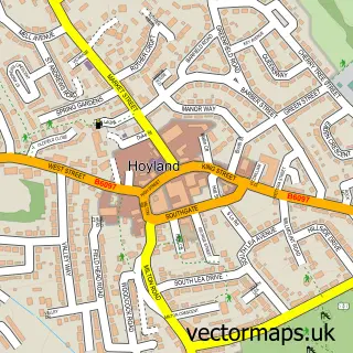
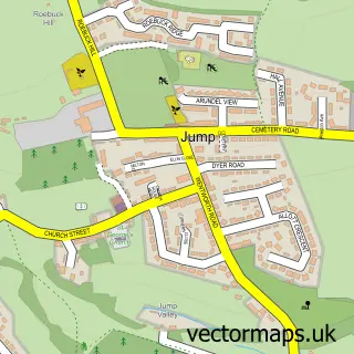
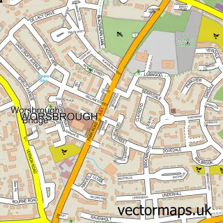
This Upper Hoyland street map is a detailed vector street map covering a 750m x 750m area. Select a larger area to create and download your own vector street map of Upper Hoyland.
The 750-metre map sample for Upper Hoyland covers 146 mapped buildings and approximately 10.7 km of road detail, of which 10 named roads are named. The immediate area includes 3 GP surgeries within 2 miles and 12 MOT stations within 2 miles. The wider area around Upper Hoyland features 1 tourism point of interest. To create a larger or custom map of Upper Hoyland, the map builder lets you define your own coverage area and download editable SVG, PDF and PNG files.
Create a larger editable map of Upper Hoyland
Choose any area you need and generate a high-quality vector map instantly. Perfect for print, planning, design, business and personal use.

This Upper Hoyland street map in South Yorkshire is available as downloadable SVG, PDF and PNG map files, or as a printed map for planning, business, display, education, local information and design work. You can also create a larger custom map area using the map selector.
What this Upper Hoyland map sample shows
Upper Hoyland lies within Barnsley District (B) parish, part of Rockingham ward in the Barnsley District (B) local authority area. The postcode geography for this area includes the S postcode area, the S74 postcode district and the S74 9 postcode sector. Residents fall under the Nhs South Yorkshire Integrated Care Board for NHS services.
Local features near Upper Hoyland
Within 2 milesAmenities and services in and around Upper Hoyland.
Administrative and postcode information for Upper Hoyland
Upper Hoyland lies within Barnsley District (B) parish, part of Rockingham ward in the Barnsley District (B) local authority area. The postcode geography for this area includes the S postcode area, the S74 postcode district and the S74 9 postcode sector. Residents fall under the Nhs South Yorkshire Integrated Care Board for NHS services.
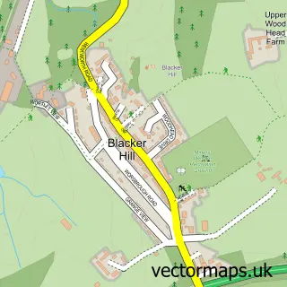
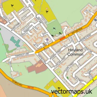
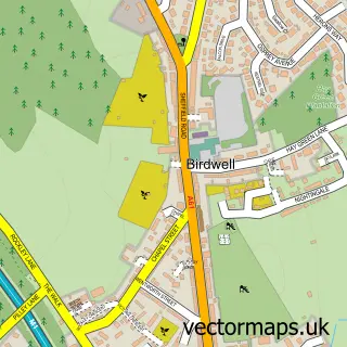
Nearby street map samples around Upper Hoyland

More street maps in South Yorkshire
750 metre map area coverage
Boundary, postcode and point of interest information for the 750m x 750m rectangle centred on this sample map.
Boundaries containing map centre
Constituency: Barnsley South Co Const
District: Barnsley District (B)
Icb: NHS South Yorkshire ICB
Police Force: south yorkshire
Postcode District: S74
Postcode Sector: S74 9
Ward: Rockingham Ward
Nearby boundaries intersecting sample
Postcode Sector: S74 0
Ward: Hoyland Milton Ward
Postcode coverage
POI category counts
Civil Engineers: 2
Contractor: 2
Agriculture: 1
Auto Body Shop: 1
Auto Customization: 1
Automotive Parts And Accessories: 1
Building Contractor: 1
Farm: 1
Forest: 1
Freight And Cargo Service: 1
Sample points of interest
- R a & C a Cowgill & Son
- CRS Accident Repair Centre
- Nortech Performance
- Universal Components Truck and Trailer Parts
- Euramax Solutions
- Minova International Ltd.
- Minova International Ltd.
- Euramax Solutions Ltd
- Tille
- Lower Sycamore Farm
- Forest of Dean Gloucestershire
- DHL Express Sheffield
Create a larger editable map of Upper Hoyland
This sample shows only a 750 metre area. To create a larger map of Upper Hoyland, use our map builder to choose your own coverage area, add titles and download editable SVG, PDF and PNG files.
Create a custom map of Upper Hoyland