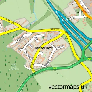
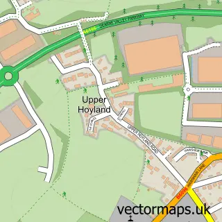
This Pilley street map is a detailed vector street map covering a 750m x 750m area. Select a larger area to create and download your own vector street map of Pilley.
The 750-metre map sample for Pilley covers 215 mapped buildings and approximately 7.2 km of road detail, of which 10 named roads are named. The immediate area includes 3 MOT stations within 2 miles. The wider area around Pilley features 1 tourism point of interest. To create a larger or custom map of Pilley, the map builder lets you define your own coverage area and download editable SVG, PDF and PNG files.
Create a larger editable map of Pilley
Choose any area you need and generate a high-quality vector map instantly. Perfect for print, planning, design, business and personal use.

This Pilley street map in South Yorkshire is available as downloadable SVG, PDF and PNG map files, or as a printed map for planning, business, display, education, local information and design work. You can also create a larger custom map area using the map selector.
What this Pilley map sample shows
Pilley lies within Tankersley Cp parish, part of Penistone East ward in the Barnsley District (B) local authority area. The postcode geography for this area includes the S postcode area, the S75 postcode district and the S75 3 postcode sector. Residents fall under the Nhs South Yorkshire Integrated Care Board for NHS services.
Local features near Pilley
Within 2 milesAmenities and services in and around Pilley.
Administrative and postcode information for Pilley
Pilley lies within Tankersley Cp parish, part of Penistone East ward in the Barnsley District (B) local authority area. The postcode geography for this area includes the S postcode area, the S75 postcode district and the S75 3 postcode sector. Residents fall under the Nhs South Yorkshire Integrated Care Board for NHS services.
Nearby street map samples around Pilley


More street maps in South Yorkshire
750 metre map area coverage
Boundary, postcode and point of interest information for the 750m x 750m rectangle centred on this sample map.
Boundaries containing map centre
Constituency: Penistone and Stocksbridge Co Const
District: Barnsley District (B)
Icb: NHS South Yorkshire ICB
Parish: Tankersley CP
Police Force: south yorkshire
Postcode District: S75
Postcode Sector: S75 3
Ward: Penistone East Ward
Nearby boundaries intersecting sample
No additional intersecting boundaries found.
Postcode coverage
POI category counts
Post Office: 2
Anglican Church: 1
Community Center: 1
Community Services Non Profits: 1
Fitness Trainer: 1
Hvac Services: 1
Martial Arts Club: 1
Nail Salon: 1
Park: 1
Performing Arts: 1
Sample points of interest
- St Paul's
- Tankersley Hub
- Wath, West Melton & District Canine Society
- Fit Around Life
- Cool Comfort
- Aspire Taekwondo
- Miss Gem's Nails and Beauty
- Pilley Pocket Park
- Rachel Cooper's Dance & Creative Arts Academy
- Post Office-Tankersley
- Tankersley Post Office
- Tankersley Tots 2 Toddlers Playgroup
Create a larger editable map of Pilley
This sample shows only a 750 metre area. To create a larger map of Pilley, use our map builder to choose your own coverage area, add titles and download editable SVG, PDF and PNG files.
Create a custom map of Pilley