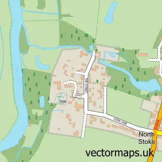
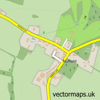
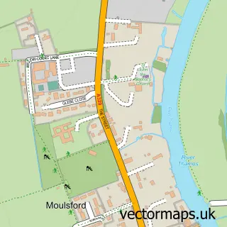
This Ipsden street map is a detailed vector street map covering a 750m x 750m area. Select a larger area to create and download your own vector street map of Ipsden.
The 750-metre map sample for Ipsden covers 60 mapped buildings and approximately 9.0 km of road detail, of which 3 named roads are named. To create a larger or custom map of Ipsden, the map builder lets you define your own coverage area and download editable SVG, PDF and PNG files.
Create a larger editable map of Ipsden
Choose any area you need and generate a high-quality vector map instantly. Perfect for print, planning, design, business and personal use.

This Ipsden street map in Oxfordshire is available as downloadable SVG, PDF and PNG map files, or as a printed map for planning, business, display, education, local information and design work. You can also create a larger custom map area using the map selector.
What this Ipsden map sample shows
Ipsden lies within Ipsden Cp parish, part of Woodcote & Rotherfield ward in the South Oxfordshire District local authority area. The postcode geography for this area includes the OX postcode area, the OX10 postcode district and the OX10 6 postcode sector. Residents fall under the Nhs Buckinghamshire, Oxfordshire And Berkshire West Integrated Care Board for NHS services.
Administrative and postcode information for Ipsden
Ipsden lies within Ipsden Cp parish, part of Woodcote & Rotherfield ward in the South Oxfordshire District local authority area. The postcode geography for this area includes the OX postcode area, the OX10 postcode district and the OX10 6 postcode sector. Residents fall under the Nhs Buckinghamshire, Oxfordshire And Berkshire West Integrated Care Board for NHS services.
Nearby street map samples around Ipsden

More street maps in Oxfordshire
750 metre map area coverage
Boundary, postcode and point of interest information for the 750m x 750m rectangle centred on this sample map.
Boundaries containing map centre
Constituency: Henley and Thame Co Const
County: Oxfordshire County
District: South Oxfordshire District
Icb: NHS Thames Valley ICB
Parish: Ipsden CP
Police Force: thames valley
Postcode District: OX10
Postcode Sector: OX10 6
Ward: Woodcote & Rotherfield Ward
Nearby boundaries intersecting sample
No additional intersecting boundaries found.
Postcode coverage
POI category counts
Community Center: 1
Dance School: 1
Home Service: 1
Real Estate Agent: 1
Shipping Center: 1
Sample points of interest
- Ipsden Village Hall
- BellyFire School of Bellydance
- Early Days Nursery
- Pea Green Projects
- Ipsden Post Office
Create a larger editable map of Ipsden
This sample shows only a 750 metre area. To create a larger map of Ipsden, use our map builder to choose your own coverage area, add titles and download editable SVG, PDF and PNG files.
Create a custom map of Ipsden