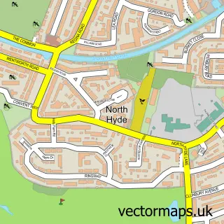
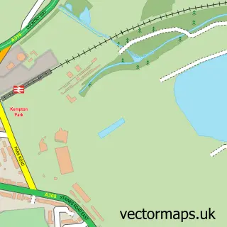
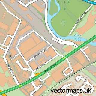
This Isleworth street map is a detailed vector street map covering a 750m x 750m area. Select a larger area to create and download your own vector street map of Isleworth.
The 750-metre map sample for Isleworth covers 299 mapped buildings and approximately 18.1 km of road detail, of which 46 named roads are named. The immediate area includes 3 primary schools and 1 secondary school, 1 GP surgery, with 28 within 2 miles, 9 pubs and 2 MOT stations, with 35 within 2 miles. The wider area around Isleworth features 8 tourism points of interest, 18 food and drink venues and 2 hotels. To create a larger or custom map of Isleworth, the map builder lets you define your own coverage area and download editable SVG, PDF and PNG files.
Create a larger editable map of Isleworth
Choose any area you need and generate a high-quality vector map instantly. Perfect for print, planning, design, business and personal use.

This Isleworth street map in Greater London is available as downloadable SVG, PDF and PNG map files, or as a printed map for planning, business, display, education, local information and design work. You can also create a larger custom map area using the map selector.
What this Isleworth map sample shows
Isleworth lies within Greater London Authority parish, part of Isleworth ward in the Hounslow London Boro local authority area. The postcode geography for this area includes the TW postcode area, the TW7 postcode district and the TW7 7 postcode sector. Residents fall under the Nhs North West London Integrated Care Board for NHS services.
Local features near Isleworth
Within 2 milesAmenities and services in and around Isleworth.
Administrative and postcode information for Isleworth
The local authority covering Isleworth is Hounslow London Boro, within the county of Greater London. The settlement lies within Isleworth ward and Greater London Authority civil parish. The TW7 postcode district and TW7 7 postcode sector serve the immediate area. NHS provision in the area is delivered through Chelsea And Westminster Hospital Nhs Foundation Trust.
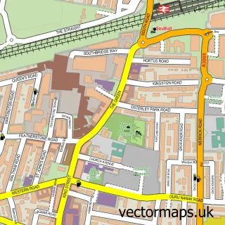
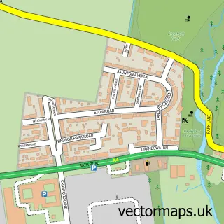
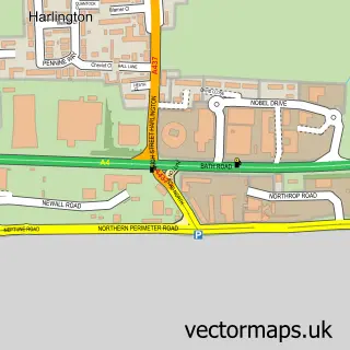
Nearby street map samples around Isleworth


More street maps in Greater London
750 metre map area coverage
Boundary, postcode and point of interest information for the 750m x 750m rectangle centred on this sample map.
Boundaries containing map centre
Constituency: Brentford and Isleworth Boro Const
County: Greater London Authority
District: Hounslow London Boro
Icb: NHS West and North London IC
Police Force: metropolitan
Postcode District: TW7
Postcode Sector: TW7 7
Ward: Isleworth Ward
Nearby boundaries intersecting sample
Constituency: Twickenham Boro Const
District: Richmond upon Thames London Boro
Icb: NHS South West London ICB
Postcode District: TW1
Postcode Sector: TW1 1, TW7 6
Ward: North Richmond Ward, St. Margarets & North Twickenham Ward, Syon & Brentford Lock Ward
Postcode coverage
POI category counts
Pub: 9
Professional Services: 7
Building Supply Store: 6
Cafe: 5
Doctor: 5
Charity Organization: 4
Church Cathedral: 4
Contractor: 4
Travel Agents: 4
Travel Services: 4
Sample points of interest
- Old Isleworth
- Accountancy Management Services Ltd.
- Swan Media
- David Bailey Hypnotherapist
- The Old Isleworth Practice
- Your Extra Space
- OzLight
- Hei Hing
- Charlotte House
- The Cooperative Food Isleworth - South Street (SWAP)
- West London Car Customs
- Manning & Boyce Accident Repairs Limited
Create a larger editable map of Isleworth
This sample shows only a 750 metre area. To create a larger map of Isleworth, use our map builder to choose your own coverage area, add titles and download editable SVG, PDF and PNG files.
Create a custom map of Isleworth