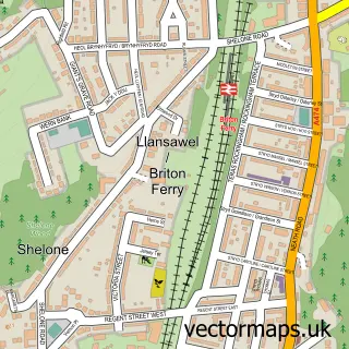
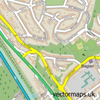
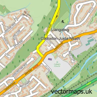
This Jersey Marine street map is a detailed vector street map covering a 750m x 750m area. Select a larger area to create and download your own vector street map of Jersey Marine.
The 750-metre map sample for Jersey Marine covers 161 mapped buildings and approximately 13.7 km of road detail, of which 9 named roads are named. The immediate area includes 1 school and 2 MOT stations within 2 miles. The wider area around Jersey Marine features 1 tourism point of interest and 3 hotels. To create a larger or custom map of Jersey Marine, the map builder lets you define your own coverage area and download editable SVG, PDF and PNG files.
Create a larger editable map of Jersey Marine
Choose any area you need and generate a high-quality vector map instantly. Perfect for print, planning, design, business and personal use.

This Jersey Marine street map in West Glamorgan is available as downloadable SVG, PDF and PNG map files, or as a printed map for planning, business, display, education, local information and design work. You can also create a larger custom map area using the map selector.
What this Jersey Marine map sample shows
Jersey Marine lies within Coedffranc Community parish, part of Coedffranc West ward in the Castell-Nedd Port Talbot - Neath Port Talbot local authority area. The postcode geography for this area includes the SA postcode area, the SA10 postcode district and the SA10 6 postcode sector. Residents fall under the Swansea Bay University Local Health Board for NHS services.
Local features near Jersey Marine
Within 2 milesAmenities and services in and around Jersey Marine.
Administrative and postcode information for Jersey Marine
Jersey Marine lies within Coedffranc Community parish, part of Coedffranc West ward in the Castell-Nedd Port Talbot - Neath Port Talbot local authority area. The postcode geography for this area includes the SA postcode area, the SA10 postcode district and the SA10 6 postcode sector. Residents fall under the Swansea Bay University Local Health Board for NHS services.
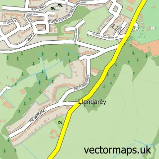
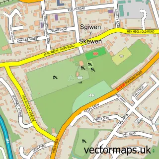
Nearby street map samples around Jersey Marine

More street maps in West Glamorgan
750 metre map area coverage
Boundary, postcode and point of interest information for the 750m x 750m rectangle centred on this sample map.
Boundaries containing map centre
Constituency: Neath and Swansea East Co Const
District: Castell-nedd Port Talbot - Neath Port Talbot
Icb: Abertawe Bro Morgannwg University
Parish: Coedffranc Community
Police Force: south wales
Postcode District: SA10
Postcode Sector: SA10 6
Nearby boundaries intersecting sample
Postcode District: SA1
Postcode Sector: SA1 8
Postcode coverage
POI category counts
Hotel: 3
Agricultural Service: 1
Beach: 1
Beauty And Spa: 1
Building Supply Store: 1
Elementary School: 1
Hvac Services: 1
Junk Removal And Hauling: 1
Landmark And Historical Building: 1
Plumbing: 1
Sample points of interest
- Pen Isar Coed Farm Limited
- Rotherslade Huts
- All Things Beauty Swansea
- Clean Carpets Swansea
- Crymlyn Primary School
- The Towers Hotel & Spa
- The Towers Hotel & Spa, Swansea Bay
- Towers Hotel and Spa
- Tankertech
- JA - Man & A Van
- Coedffranc West
- Greenow
Create a larger editable map of Jersey Marine
This sample shows only a 750 metre area. To create a larger map of Jersey Marine, use our map builder to choose your own coverage area, add titles and download editable SVG, PDF and PNG files.
Create a custom map of Jersey Marine