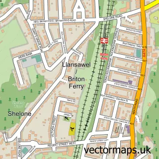
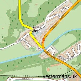
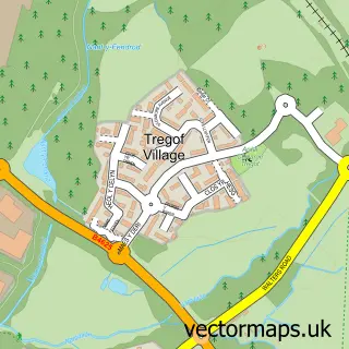
This Skewen street map is a detailed vector street map covering a 750m x 750m area. Select a larger area to create and download your own vector street map of Skewen.
The 750-metre map sample for Skewen covers 517 mapped buildings and approximately 16.7 km of road detail, of which 29 named roads are named. The immediate area includes 1 school, 1 GP surgery within 2 miles and 1 MOT station, with 18 within 2 miles. The wider area around Skewen features 4 tourism points of interest and 1 food and drink venue. To create a larger or custom map of Skewen, the map builder lets you define your own coverage area and download editable SVG, PDF and PNG files.
Create a larger editable map of Skewen
Choose any area you need and generate a high-quality vector map instantly. Perfect for print, planning, design, business and personal use.

This Skewen street map in West Glamorgan is available as downloadable SVG, PDF and PNG map files, or as a printed map for planning, business, display, education, local information and design work. You can also create a larger custom map area using the map selector.
What this Skewen map sample shows
Skewen lies within Coedffranc Community parish, part of Coedffranc Central ward in the Castell-Nedd Port Talbot - Neath Port Talbot local authority area. The postcode geography for this area includes the SA postcode area, the SA10 postcode district and the SA10 6 postcode sector. Residents fall under the Swansea Bay University Local Health Board for NHS services.
Local features near Skewen
Within 2 milesAmenities and services in and around Skewen.
Administrative and postcode information for Skewen
The local authority covering Skewen is Castell-Nedd Port Talbot - Neath Port Talbot, within the county of West Glamorgan. The settlement lies within Coedffranc Central ward and Coedffranc Community civil parish. The SA10 postcode district and SA10 6 postcode sector serve the immediate area. NHS provision in the area is delivered through Swansea Bay University Health Board.
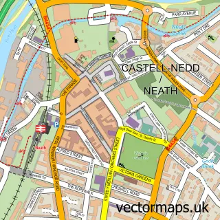
Nearby street map samples around Skewen

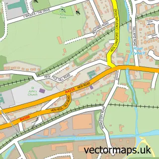
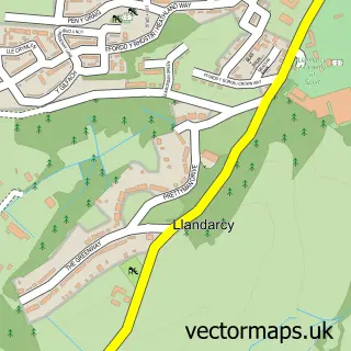
More street maps in West Glamorgan
750 metre map area coverage
Boundary, postcode and point of interest information for the 750m x 750m rectangle centred on this sample map.
Boundaries containing map centre
Constituency: Neath and Swansea East Co Const
District: Castell-nedd Port Talbot - Neath Port Talbot
Icb: Abertawe Bro Morgannwg University
Parish: Coedffranc Community
Police Force: south wales
Postcode District: SA10
Postcode Sector: SA10 6
Nearby boundaries intersecting sample
No additional intersecting boundaries found.
Postcode coverage
POI category counts
Automotive Repair: 4
Convenience Store: 4
Sports Club And League: 4
Park: 3
Building Supply Store: 2
Carpenter: 2
Church Cathedral: 2
Community Center: 2
Contractor: 2
Pet Services: 2
Sample points of interest
- Swansea Electrical
- C.C.S. Neath Electrics Ltd.
- PBS Telematics - Vehicle tracking, Dash cams, Fleet Management.
- CWM Upholstery
- P & T Autos
- P and T Autos
- Select Accident Repair Centre
- Trumpet Tyres
- DLJones Plant & Agricultural Services
- Stephen Jenkins
- Munchies Kebab
- A Room At The Top
Create a larger editable map of Skewen
This sample shows only a 750 metre area. To create a larger map of Skewen, use our map builder to choose your own coverage area, add titles and download editable SVG, PDF and PNG files.
Create a custom map of Skewen