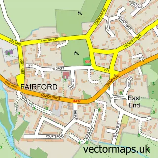
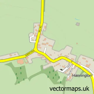
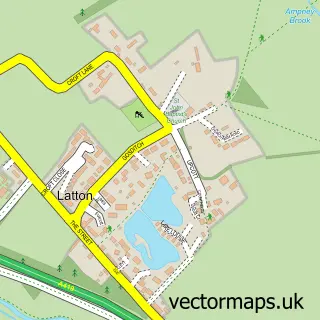
This Kempsford street map is a detailed vector street map covering a 750m x 750m area. Select a larger area to create and download your own vector street map of Kempsford.
The 750-metre map sample for Kempsford covers 257 mapped buildings and approximately 11.8 km of road detail, of which 20 named roads are named. The immediate area includes 1 school, 1 pub and 2 MOT stations within 2 miles. The wider area around Kempsford features 1 tourism point of interest, 2 food and drink venues and 2 hotels. To create a larger or custom map of Kempsford, the map builder lets you define your own coverage area and download editable SVG, PDF and PNG files.
Create a larger editable map of Kempsford
Choose any area you need and generate a high-quality vector map instantly. Perfect for print, planning, design, business and personal use.

This Kempsford street map in Gloucestershire is available as downloadable SVG, PDF and PNG map files, or as a printed map for planning, business, display, education, local information and design work. You can also create a larger custom map area using the map selector.
What this Kempsford map sample shows
Kempsford lies within Kempsford Cp parish, part of Lechlade, Kempsford & Fairford South ward in the Cotswold District local authority area. The postcode geography for this area includes the GL postcode area, the GL7 postcode district and the GL7 4 postcode sector. Residents fall under the Nhs Gloucestershire Integrated Care Board for NHS services.
Local features near Kempsford
Within 2 milesAmenities and services in and around Kempsford.
Administrative and postcode information for Kempsford
Kempsford lies within Kempsford Cp parish, part of Lechlade, Kempsford & Fairford South ward in the Cotswold District local authority area. The postcode geography for this area includes the GL postcode area, the GL7 postcode district and the GL7 4 postcode sector. Residents fall under the Nhs Gloucestershire Integrated Care Board for NHS services.
Nearby street map samples around Kempsford

More street maps in Gloucestershire
750 metre map area coverage
Boundary, postcode and point of interest information for the 750m x 750m rectangle centred on this sample map.
Boundaries containing map centre
Constituency: South Cotswolds Co Const
County: Gloucestershire County
District: Cotswold District
Icb: NHS Gloucestershire ICB
Parish: Kempsford CP
Police Force: gloucestershire
Postcode District: GL7
Postcode Sector: GL7 4
Ward: Lechlade, Kempsford & Fairford South Ward
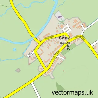
Nearby boundaries intersecting sample
Constituency: Swindon North Co Const
District: Swindon (B)
Icb: NHS Bath and North East Somerset Swindon and Wiltshire ICB
Parish: Castle Eaton CP
Police Force: wiltshire
Postcode District: SN6
Postcode Sector: SN6 6
Ward: Blunsdon and Highworth Ward
Postcode coverage
POI category counts
Hotel: 2
Active Life: 1
Beauty Salon: 1
Building Supply Store: 1
Cafe: 1
Community Center: 1
Elementary School: 1
Flowers And Gifts Shop: 1
Furniture Assembly: 1
Park: 1
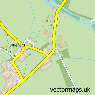
Sample points of interest
- WhelfordPools Fisheries
- Your Inspired Beauty
- Mike Lenik
- Magic Beans Cafe
- Kempsford Village Hall
- Kempsford Church of England School
- Corky and Prince Wedding & Event Flowers
- Harriet Guest Upholstery
- Kempsford Post Office
- Post Office-Kempsford
- Daily Shop
- My Best Friend South Cotswolds
Create a larger editable map of Kempsford
This sample shows only a 750 metre area. To create a larger map of Kempsford, use our map builder to choose your own coverage area, add titles and download editable SVG, PDF and PNG files.
Create a custom map of Kempsford