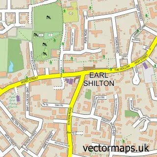
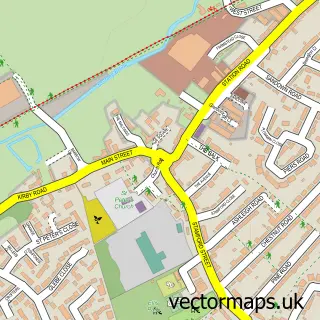
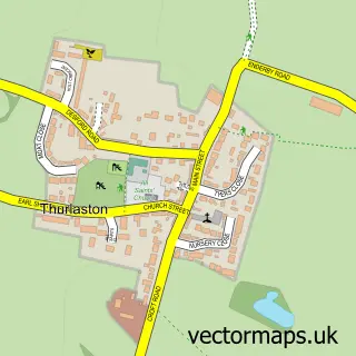
This Leicester Forest East street map is a detailed vector street map covering a 750m x 750m area. Select a larger area to create and download your own vector street map of Leicester Forest East.
The 750-metre map sample for Leicester Forest East covers 590 mapped buildings and approximately 23.6 km of road detail, of which 41 named roads are named. The immediate area includes 1 school, 4 GP surgeries within 2 miles and 9 MOT stations within 2 miles. The wider area around Leicester Forest East features 1 food and drink venue and 1 hotel. To create a larger or custom map of Leicester Forest East, the map builder lets you define your own coverage area and download editable SVG, PDF and PNG files.
Create a larger editable map of Leicester Forest East
Choose any area you need and generate a high-quality vector map instantly. Perfect for print, planning, design, business and personal use.

This Leicester Forest East street map in Leicestershire is available as downloadable SVG, PDF and PNG map files, or as a printed map for planning, business, display, education, local information and design work. You can also create a larger custom map area using the map selector.
What this Leicester Forest East map sample shows
Leicester Forest East lies within Kirby Muxloe Cp parish, part of Forest ward in the Blaby District local authority area. The postcode geography for this area includes the LE postcode area, the LE3 postcode district and the LE3 3 postcode sector. Residents fall under the Nhs Leicester, Leicestershire And Rutland Integrated Care Board for NHS services.
Local features near Leicester Forest East
Within 2 milesAmenities and services in and around Leicester Forest East.
Administrative and postcode information for Leicester Forest East
The local authority covering Leicester Forest East is Blaby District, within the county of Leicestershire. The settlement lies within Forest ward and Kirby Muxloe Cp civil parish. The LE3 postcode district and LE3 3 postcode sector serve the immediate area. NHS provision in the area is delivered through University Hospitals Of Leicester Nhs Trust.
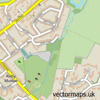
Nearby street map samples around Leicester Forest East

More street maps in Leicestershire
750 metre map area coverage
Boundary, postcode and point of interest information for the 750m x 750m rectangle centred on this sample map.
Boundaries containing map centre
Constituency: Mid Leicestershire Co Const
County: Leicestershire County
District: Blaby District
Icb: NHS Leicester Leicestershire and Rutland ICB
Parish: Leicester Forest East CP
Police Force: leicestershire
Postcode District: LE3
Postcode Sector: LE3 3
Ward: Leicester Forest & Lubbesthorpe Ward
Nearby boundaries intersecting sample
Constituency: South Leicestershire Co Const
Parish: Kirby Muxloe CP, Lubbesthorpe CP
Postcode District: LE19, LE9
Postcode Sector: LE19 4, LE9 2
Ward: Kirby Muxloe Ward
Postcode coverage
POI category counts
Real Estate Agent: 4
Arts And Crafts: 2
Building Supply Store: 2
Contractor: 2
Elementary School: 2
Landscape Architect: 2
Professional Services: 2
Vocational And Technical School: 2
Advertising Agency: 1
Automotive Repair: 1
Sample points of interest
- OpenBox Promotions Ltd
- Calligraphy Arts
- Calligraphy Arts
- A Mobile Mechanic
- HoneyComb's
- Grange Windows
- A 2 C Flooring
- JDW Electrical Specialists
- Kindling King
- Fulcrum Automotive
- Harrison Plastering
- Stewart Building Services
Create a larger editable map of Leicester Forest East
This sample shows only a 750 metre area. To create a larger map of Leicester Forest East, use our map builder to choose your own coverage area, add titles and download editable SVG, PDF and PNG files.
Create a custom map of Leicester Forest East