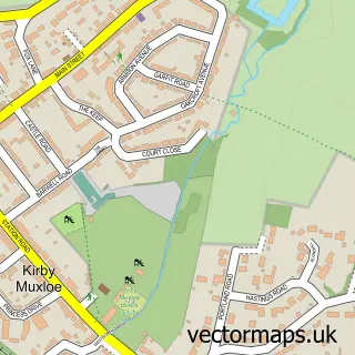
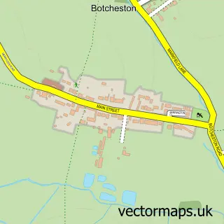
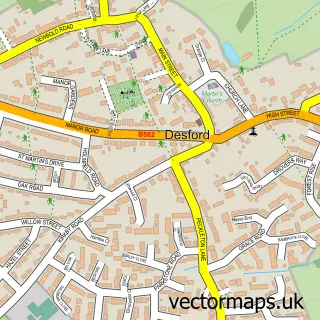
This Ratby street map is a detailed vector street map covering a 750m x 750m area. Select a larger area to create and download your own vector street map of Ratby.
The 750-metre map sample for Ratby covers 493 mapped buildings and approximately 28.2 km of road detail, of which 43 named roads are named. The immediate area includes 1 school, 1 GP surgery, with 3 within 2 miles, 2 pubs and 1 MOT station, with 5 within 2 miles. The wider area around Ratby features 1 tourism point of interest and 3 food and drink venues. To create a larger or custom map of Ratby, the map builder lets you define your own coverage area and download editable SVG, PDF and PNG files.
Create a larger editable map of Ratby
Choose any area you need and generate a high-quality vector map instantly. Perfect for print, planning, design, business and personal use.

This Ratby street map in Leicestershire is available as downloadable SVG, PDF and PNG map files, or as a printed map for planning, business, display, education, local information and design work. You can also create a larger custom map area using the map selector.
What this Ratby map sample shows
Ratby lies within Ratby Cp parish, part of Ratby, Bagworth And Thornton ward in the Hinckley And Bosworth District (B) local authority area. The postcode geography for this area includes the LE postcode area, the LE6 postcode district and the LE6 0 postcode sector. Residents fall under the Nhs Leicester, Leicestershire And Rutland Integrated Care Board for NHS services.
Local features near Ratby
Within 2 milesAmenities and services in and around Ratby.
Administrative and postcode information for Ratby
Ratby lies within Ratby Cp parish, part of Ratby, Bagworth And Thornton ward in the Hinckley And Bosworth District (B) local authority area. The postcode geography for this area includes the LE postcode area, the LE6 postcode district and the LE6 0 postcode sector. Residents fall under the Nhs Leicester, Leicestershire And Rutland Integrated Care Board for NHS services.
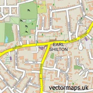
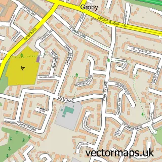
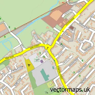
Nearby street map samples around Ratby

More street maps in Leicestershire
750 metre map area coverage
Boundary, postcode and point of interest information for the 750m x 750m rectangle centred on this sample map.
Boundaries containing map centre
Constituency: Mid Leicestershire Co Const
County: Leicestershire County
District: Hinckley and Bosworth District (B)
Icb: NHS Leicester Leicestershire and Rutland ICB
Parish: Ratby CP
Police Force: leicestershire
Postcode District: LE6
Postcode Sector: LE6 0
Ward: Ratby, Bagworth and Thornton Ward
Nearby boundaries intersecting sample
No additional intersecting boundaries found.
Postcode coverage
POI category counts
Professional Services: 3
Automotive Repair: 2
Barber: 2
Church Cathedral: 2
Convenience Store: 2
Doctor: 2
Employment Agencies: 2
Post Office: 2
Pub: 2
Accommodation: 1
Sample points of interest
- Shipman House
- Ratby Town Cricket Club
- Ratby: St Philip & St James
- Pro Smart
- Ratby M O T Station
- Main St. Barbers
- The Cutting Station
- Honeycomb hair salon
- Grace Ann Beauty
- Leicester Books & Gifts
- ACM Mechanical Services Ltd
- Meg-a Cakes Cafe
Create a larger editable map of Ratby
This sample shows only a 750 metre area. To create a larger map of Ratby, use our map builder to choose your own coverage area, add titles and download editable SVG, PDF and PNG files.
Create a custom map of Ratby