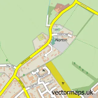
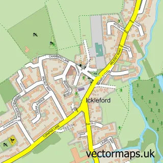
This Letchworth street map is a detailed vector street map covering a 750m x 750m area. Select a larger area to create and download your own vector street map of Letchworth.
The 750-metre map sample for Letchworth covers 338 mapped buildings and approximately 16.2 km of road detail, of which 28 named roads are named. The immediate area includes 1 railway station, 3 GP surgeries, with 4 within 2 miles, 7 pubs and 1 MOT station, with 22 within 2 miles. The wider area around Letchworth features 6 tourism points of interest, 26 food and drink venues and 2 hotels. To create a larger or custom map of Letchworth, the map builder lets you define your own coverage area and download editable SVG, PDF and PNG files.
Create a larger editable map of Letchworth
Choose any area you need and generate a high-quality vector map instantly. Perfect for print, planning, design, business and personal use.

This Letchworth street map in Hertfordshire is available as downloadable SVG, PDF and PNG map files, or as a printed map for planning, business, display, education, local information and design work. You can also create a larger custom map area using the map selector.
What this Letchworth map sample shows
Letchworth lies within Hertfordshire County parish, part of Letchworth South West ward in the North Hertfordshire District local authority area. The postcode geography for this area includes the SG postcode area, the SG6 postcode district and the SG6 2 postcode sector. Residents fall under the Nhs Hertfordshire And West Essex Integrated Care Board for NHS services.
Local features near Letchworth
Within 2 milesAmenities and services in and around Letchworth.
Administrative and postcode information for Letchworth
The local authority covering Letchworth is North Hertfordshire District, within the county of Hertfordshire. The settlement lies within Letchworth South West ward and Hertfordshire County civil parish. The SG6 postcode district and SG6 2 postcode sector serve the immediate area. NHS provision in the area is delivered through East And North Hertfordshire Nhs Trust.
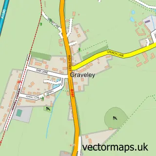
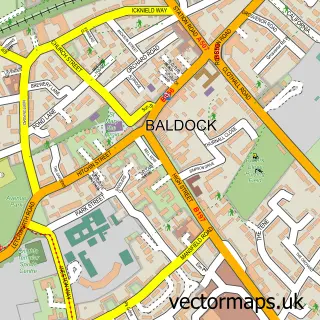
Nearby street map samples around Letchworth

More street maps in Hertfordshire
750 metre map area coverage
Boundary, postcode and point of interest information for the 750m x 750m rectangle centred on this sample map.
Boundaries containing map centre
Constituency: North East Hertfordshire Co Const
County: Hertfordshire County
District: North Hertfordshire District
Icb: NHS Central East ICB
Police Force: hertfordshire
Postcode District: SG6
Postcode Sector: SG6 3
Ward: Letchworth South West Ward
Nearby boundaries intersecting sample
Postcode Sector: SG6 1, SG6 4
Ward: Letchworth Norton Ward, Letchworth South East Ward, Letchworth Wilbury Ward
Postcode coverage
POI category counts
Hair Salon: 15
Real Estate Agent: 12
Professional Services: 10
Coffee Shop: 9
Doctor: 9
Cafe: 8
Charity Organization: 7
Pub: 7
Thrift Store: 7
Art Gallery: 6
Sample points of interest
- Leadermans
- TaxAssist Accountants
- Khoi Khoi FC
- Angell's
- Letchworth Osteopathic & Sports Injury Clinic
- Tiffany Kirby
- Mackays Junk and Disorderly
- The Green House - Letchworth
- Dixons Carphone
- Letchworth Aquatics
- Visualisingh Ltd.
- Broadway Gallery
Create a larger editable map of Letchworth
This sample shows only a 750 metre area. To create a larger map of Letchworth, use our map builder to choose your own coverage area, add titles and download editable SVG, PDF and PNG files.
Create a custom map of Letchworth