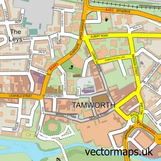
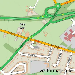
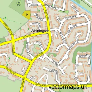
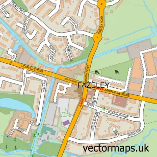
This Leyfields street map is a detailed vector street map covering a 750m x 750m area. Select a larger area to create and download your own vector street map of Leyfields.
The 750-metre map sample for Leyfields covers 394 mapped buildings and approximately 25.5 km of road detail, of which 41 named roads are named. The immediate area includes 7 GP surgeries within 2 miles, 2 pubs and 20 MOT stations within 2 miles. The wider area around Leyfields features 1 tourism point of interest and 2 food and drink venues. To create a larger or custom map of Leyfields, the map builder lets you define your own coverage area and download editable SVG, PDF and PNG files.
Create a larger editable map of Leyfields
Choose any area you need and generate a high-quality vector map instantly. Perfect for print, planning, design, business and personal use.

This Leyfields street map in Staffordshire is available as downloadable SVG, PDF and PNG map files, or as a printed map for planning, business, display, education, local information and design work. You can also create a larger custom map area using the map selector.
What this Leyfields map sample shows
Leyfields lies within Staffordshire County parish, part of Castle ward in the Tamworth District (B) local authority area. The postcode geography for this area includes the B postcode area, the B79 postcode district and the B79 7 postcode sector. Residents fall under the Nhs Staffordshire And Stoke-On-Trent Integrated Care Board for NHS services.
Local features near Leyfields
Within 2 milesAmenities and services in and around Leyfields.
Administrative and postcode information for Leyfields
Leyfields lies within Staffordshire County parish, part of Castle ward in the Tamworth District (B) local authority area. The postcode geography for this area includes the B postcode area, the B79 postcode district and the B79 7 postcode sector. Residents fall under the Nhs Staffordshire And Stoke-On-Trent Integrated Care Board for NHS services.
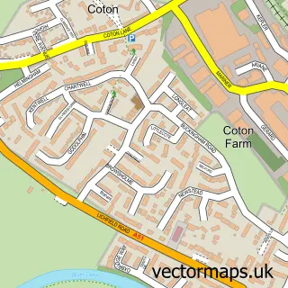
Nearby street map samples around Leyfields

More street maps in Staffordshire
750 metre map area coverage
Boundary, postcode and point of interest information for the 750m x 750m rectangle centred on this sample map.
Boundaries containing map centre
Constituency: Tamworth Co Const
County: Staffordshire County
District: Tamworth District (B)
Icb: NHS Black Country ICB
Police Force: staffordshire
Postcode District: B79
Postcode Sector: B79 8
Ward: Mercian Ward
Nearby boundaries intersecting sample
Ward: Spital Ward
Postcode coverage
POI category counts
Atms: 3
Driving School: 3
Medical Center: 3
Building Supply Store: 2
Butcher Shop: 2
Convenience Store: 2
Gardener: 2
Gym: 2
Pub: 2
Religious Organization: 2
Sample points of interest
- Leyfields
- Saint Francis, Leyfields
- ATM (Post Office)
- Atm
- BR Spar Masefield Drive, LEYFIELDS
- Beauty Berry
- Ruth's Cake House
- ATR Decorating Specialists
- Eco Gas Midlands Limited
- Jsp Credit Management
- Smith And Ellis Traditional Butchers
- Smith and Ellis Butchers
Create a larger editable map of Leyfields
This sample shows only a 750 metre area. To create a larger map of Leyfields, use our map builder to choose your own coverage area, add titles and download editable SVG, PDF and PNG files.
Create a custom map of Leyfields