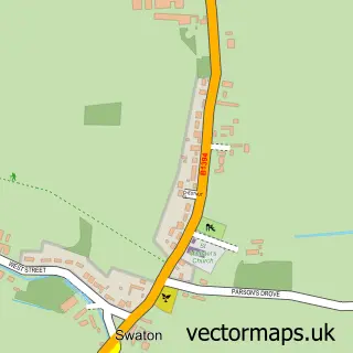
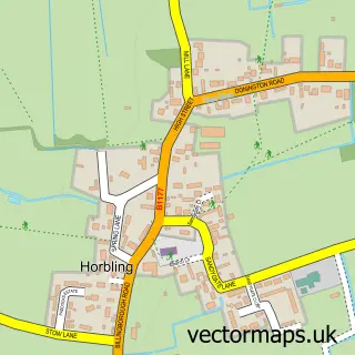
This Little Hale street map is a detailed vector street map covering a 750m x 750m area. Select a larger area to create and download your own vector street map of Little Hale.
The 750-metre map sample for Little Hale covers 119 mapped buildings and approximately 8.6 km of road detail, of which 4 named roads are named. The immediate area includes 1 GP surgery within 2 miles and 3 MOT stations within 2 miles. To create a larger or custom map of Little Hale, the map builder lets you define your own coverage area and download editable SVG, PDF and PNG files.
Create a larger editable map of Little Hale
Choose any area you need and generate a high-quality vector map instantly. Perfect for print, planning, design, business and personal use.

This Little Hale street map in Lincolnshire is available as downloadable SVG, PDF and PNG map files, or as a printed map for planning, business, display, education, local information and design work. You can also create a larger custom map area using the map selector.
What this Little Hale map sample shows
Little Hale lies within Little Hale Cp parish, part of Heckington Rural ward in the North Kesteven District local authority area. The postcode geography for this area includes the NG postcode area, the NG34 postcode district and the NG34 9 postcode sector. Residents fall under the Nhs Lincolnshire Integrated Care Board for NHS services.
Local features near Little Hale
Within 2 milesAmenities and services in and around Little Hale.
Administrative and postcode information for Little Hale
The local authority covering Little Hale is North Kesteven District, within the county of Lincolnshire. The settlement lies within Heckington Rural ward and Little Hale Cp civil parish. The NG34 postcode district and NG34 9 postcode sector serve the immediate area. NHS provision in the area is delivered through United Lincolnshire Hospitals Nhs Trust.
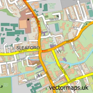
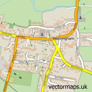
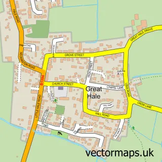
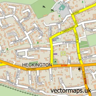
Nearby street map samples around Little Hale

More street maps in Lincolnshire
750 metre map area coverage
Boundary, postcode and point of interest information for the 750m x 750m rectangle centred on this sample map.
Boundaries containing map centre
Constituency: Grantham and Bourne Co Const
County: Lincolnshire County
District: North Kesteven District
Icb: NHS Lincolnshire ICB
Parish: Little Hale CP
Police Force: lincolnshire
Postcode District: NG34
Postcode Sector: NG34 9
Ward: Heckington Rural Ward
Nearby boundaries intersecting sample
No additional intersecting boundaries found.
Postcode coverage
POI category counts
Bridal Shop: 1
Building Supply Store: 1
Carpenter: 1
Church Cathedral: 1
Cleaning Services: 1
Funeral Services And Cemeteries: 1
Hvac Services: 1
Pet Boarding: 1
Printing Services: 1
Sample points of interest
- The Wedding Room
- Boss Scaffold Tower
- Oakwood Joinery
- Little Hale Methodist Church
- Dave Cox Cleaning Services
- J E Severs
- Burton Air Conditioning
- Paws at Home Sleaford
- Pdp Printed Products
Create a larger editable map of Little Hale
This sample shows only a 750 metre area. To create a larger map of Little Hale, use our map builder to choose your own coverage area, add titles and download editable SVG, PDF and PNG files.
Create a custom map of Little Hale