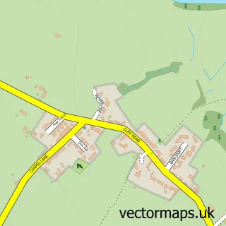
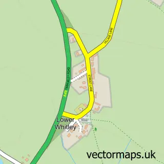
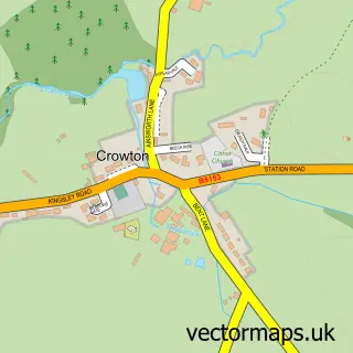
This Little Leigh street map is a detailed vector street map covering a 750m x 750m area. Select a larger area to create and download your own vector street map of Little Leigh.
The 750-metre map sample for Little Leigh covers 105 mapped buildings and approximately 9.1 km of road detail, of which 9 named roads are named. The immediate area includes 1 school, 2 GP surgeries within 2 miles and 3 MOT stations within 2 miles. To create a larger or custom map of Little Leigh, the map builder lets you define your own coverage area and download editable SVG, PDF and PNG files.
Create a larger editable map of Little Leigh
Choose any area you need and generate a high-quality vector map instantly. Perfect for print, planning, design, business and personal use.

This Little Leigh street map in Cheshire is available as downloadable SVG, PDF and PNG map files, or as a printed map for planning, business, display, education, local information and design work. You can also create a larger custom map area using the map selector.
What this Little Leigh map sample shows
Little Leigh lies within Little Leigh Cp parish, part of Marbury ward in the Cheshire West And Chester (B) local authority area. The postcode geography for this area includes the CW postcode area, the CW8 postcode district and the CW8 4 postcode sector. Residents fall under the Nhs Cheshire And Merseyside Integrated Care Board for NHS services.
Local features near Little Leigh
Within 2 milesAmenities and services in and around Little Leigh.
Administrative and postcode information for Little Leigh
Little Leigh lies within Little Leigh Cp parish, part of Marbury ward in the Cheshire West And Chester (B) local authority area. The postcode geography for this area includes the CW postcode area, the CW8 postcode district and the CW8 4 postcode sector. Residents fall under the Nhs Cheshire And Merseyside Integrated Care Board for NHS services.
Nearby street map samples around Little Leigh

More street maps in Cheshire
750 metre map area coverage
Boundary, postcode and point of interest information for the 750m x 750m rectangle centred on this sample map.
Boundaries containing map centre
Constituency: Tatton Co Const
District: Cheshire West and Chester (B)
Icb: NHS Cheshire and Merseyside ICB
Parish: Little Leigh CP
Police Force: cheshire
Postcode District: CW8
Postcode Sector: CW8 4
Ward: Marbury Ward
Nearby boundaries intersecting sample
No additional intersecting boundaries found.
Postcode coverage
POI category counts
Anglican Church: 2
Bank Credit Union: 1
Elementary School: 1
Event Planning: 1
Farm: 1
Hardware Store: 1
Sample points of interest
- St Michael & All Angels
- St Michael and All Angels Church
- Brakeley Bank Farm
- Little Leigh Primary School
- Calm The Clutter
- GM Horton and Son
- Blades Mowers
Create a larger editable map of Little Leigh
This sample shows only a 750 metre area. To create a larger map of Little Leigh, use our map builder to choose your own coverage area, add titles and download editable SVG, PDF and PNG files.
Create a custom map of Little Leigh