Vector Maps logo
Home Why it works Popular maps Districts Samples Customizer Create Your Map
VectorMaps.uk
Home Popular maps Districts Samples Customizer Create Your Map Privacy Disclaimer
Home / UK Maps / Northamptonshire / Long Buckby Map

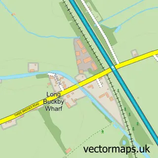
This Long Buckby street map is a detailed vector street map covering a 750m x 750m area. Select a larger area to create and download your own vector street map of Long Buckby.

Long Buckby is a village in Northamptonshire, in the East Midlands of England. The settlement falls within the Daventry parliamentary constituency. It is served by the NN6 postcode district, with NN6 7 as the local postcode sector.

The 750-metre map sample for Long Buckby covers 542 mapped buildings and approximately 31.2 km of road detail, of which 41 named roads are named. The immediate area includes 1 school, 1 GP surgery, 5 pubs and 2 MOT stations within 2 miles. The wider area around Long Buckby features 6 food and drink venues. To create a larger or custom map of Long Buckby, the map builder lets you define your own coverage area and download editable SVG, PDF and PNG files.

542Buildings
31.2 kmRoads
41Named roads
2,262Residents within 2 miles
Create your own

Create a larger editable map of Long Buckby

Choose any area you need and generate a high-quality vector map instantly. Perfect for print, planning, design, business and personal use.

Choose any location
Editable SVG files
Any size up to A0
PDF, PNG & more
Instant download
High quality guaranteed
Create My Custom Map
Secure, private & no credit card required
Long Buckby Vector Street Map
750m Sample
Long Buckby vector street map sample showing roads, buildings and local features in a 750 metre preview area
Buy Long Buckby Map Print from £12.95 Buy Long Buckby Digital Map from £6

This Long Buckby street map in Northamptonshire is available as downloadable SVG, PDF and PNG map files, or as a printed map for planning, business, display, education, local information and design work. You can also create a larger custom map area using the map selector.

What this Long Buckby map sample shows

Long Buckby lies within Long Buckby Cp parish, part of Long Buckby ward in the West Northamptonshire local authority area. The postcode geography for this area includes the NN postcode area, the NN6 postcode district and the NN6 7 postcode sector. Residents fall under the Nhs Northamptonshire Integrated Care Board for NHS services.

Local features near Long Buckby

Within 2 miles

Amenities and services in and around Long Buckby.

1 Schools
1 GP surgeries 1 within 2 miles
2 MOT stations within 2 miles
6 Food & drink
5 Pubs
7 Healthcare POIs

Counts are approximate and based on publicly available data.

Administrative and postcode information for Long Buckby

Long Buckby lies within Long Buckby Cp parish, part of Long Buckby ward in the West Northamptonshire local authority area. The postcode geography for this area includes the NN postcode area, the NN6 postcode district and the NN6 7 postcode sector. Residents fall under the Nhs Northamptonshire Integrated Care Board for NHS services.

Parish Long Buckby CP
Ward Long Buckby
District / local authority West Northamptonshire
County Northamptonshire
Historic county Northamptonshire
Postcode district NN6
Postcode sector NN6 7
Parliamentary constituency Daventry
Region East Midlands
Country England

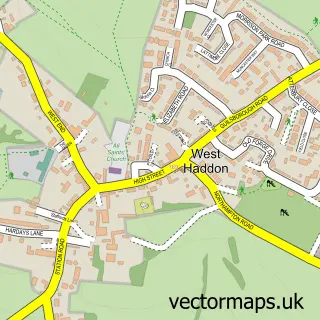
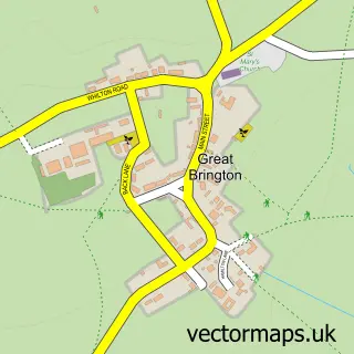
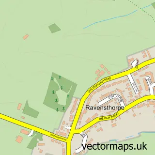
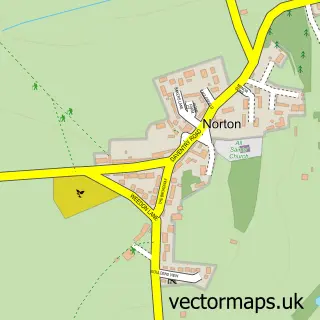
Nearby street map samples around Long Buckby

Street map sample of Daventry, Northamptonshire Daventry Town - Northamptonshire - 4.6 miles Street map sample of Coventry, West Midlands Coventry City - West Midlands - 19.5 miles Street map sample of Long Buckby Wharf, Northamptonshire Long Buckby Wharf Village - Northamptonshire - 1.6 miles Street map sample of Watford, Northamptonshire Watford Village - Northamptonshire - 1.8 miles Street map sample of Whilton, Northamptonshire Whilton Village - Northamptonshire - 1.8 miles Street map sample of East Haddon, Northamptonshire East Haddon Village - Northamptonshire - 2.5 miles Street map sample of West Haddon, Northamptonshire West Haddon Village - Northamptonshire - 2.7 miles Street map sample of Great Brington, Northamptonshire Great Brington Village - Northamptonshire - 2.9 miles Street map sample of Ravensthorpe, Northamptonshire Ravensthorpe Village - Northamptonshire - 2.9 miles Street map sample of Norton, Northamptonshire Norton Village - Northamptonshire - 2.9 miles

More street maps in Northamptonshire

Street map sample of Long Buckby Wharf, Northamptonshire Long Buckby Wharf Village - 1.6 miles Street map sample of Watford, Northamptonshire Watford Village - 1.8 miles Street map sample of Whilton, Northamptonshire Whilton Village - 1.8 miles Street map sample of East Haddon, Northamptonshire East Haddon Village - 2.5 miles Street map sample of West Haddon, Northamptonshire West Haddon Village - 2.7 miles

750 metre map area coverage

Boundary, postcode and point of interest information for the 750m x 750m rectangle centred on this sample map.

Boundaries containing map centre

Constituency: Daventry Co Const

District: West Northamptonshire

Icb: NHS Northamptonshire ICB

Parish: Long Buckby CP

Police Force: northamptonshire

Postcode District: NN6

Postcode Sector: NN6 7

Ward: Long Buckby Ward

Nearby boundaries intersecting sample

No additional intersecting boundaries found.

Postcode coverage

NN6 NN6 7

POI category counts

Pub: 5

Doctor: 4

Indian Restaurant: 4

Professional Services: 4

Barber: 3

Convenience Store: 3

Educational Services: 3

Gym: 3

Atms: 2

Automotive Services And Repair: 2

Sample points of interest

  • Market Place Accounting Services Accountant
  • Bleat P R Advertising Agency
  • The Scanning Lady Agricultural Cooperatives
  • Art by Lyndell Art School
  • PayPoint Atms
  • The Cooperative Food Long Buckby, Long Buckby Atms
  • Saint Alarms Ltd. Auto Electrical Repair
  • Bringatrailer Automotive Services And Repair
  • Buckby GameStation Automotive Services And Repair
  • Suncrest Trading Baby Gear And Furniture
  • Eleven bakery Long Buckby Bakery
  • NatWest Bank Credit Union

Create a larger editable map of Long Buckby

This sample shows only a 750 metre area. To create a larger map of Long Buckby, use our map builder to choose your own coverage area, add titles and download editable SVG, PDF and PNG files.

Create a custom map of Long Buckby

Phone 01751 473136 | Copyright Vectormaps.uk 2026

Samples Customizer Privacy Disclaimer
Long Buckby Vector Street Map
Long Buckby enlarged street map sample showing a 750 metre preview area