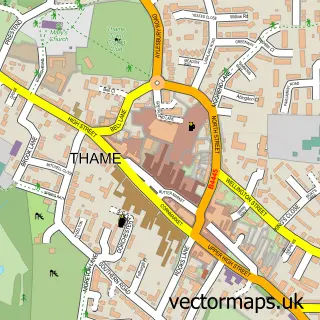
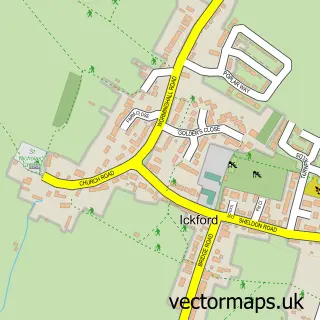
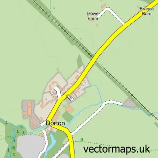
This Long Crendon street map is a detailed vector street map covering a 750m x 750m area. Select a larger area to create and download your own vector street map of Long Crendon.
The 750-metre map sample for Long Crendon covers 420 mapped buildings and approximately 26.9 km of road detail, of which 28 named roads are named. The immediate area includes 2 pubs and 1 MOT station, with 2 within 2 miles. The wider area around Long Crendon features 1 tourism point of interest and 4 food and drink venues. To create a larger or custom map of Long Crendon, the map builder lets you define your own coverage area and download editable SVG, PDF and PNG files.
Create a larger editable map of Long Crendon
Choose any area you need and generate a high-quality vector map instantly. Perfect for print, planning, design, business and personal use.

This Long Crendon street map in Buckinghamshire is available as downloadable SVG, PDF and PNG map files, or as a printed map for planning, business, display, education, local information and design work. You can also create a larger custom map area using the map selector.
What this Long Crendon map sample shows
Long Crendon lies within Long Crendon Cp parish, part of Long Crendon ward in the Buckinghamshire local authority area. The postcode geography for this area includes the HP postcode area, the HP18 postcode district and the HP18 9 postcode sector. Residents fall under the Nhs Buckinghamshire, Oxfordshire And Berkshire West Integrated Care Board for NHS services.
Local features near Long Crendon
Within 2 milesAmenities and services in and around Long Crendon.
Administrative and postcode information for Long Crendon
The local authority covering Long Crendon is Buckinghamshire, within the county of Buckinghamshire. The settlement lies within Long Crendon ward and Long Crendon Cp civil parish. The HP18 postcode district and HP18 9 postcode sector serve the immediate area. NHS provision in the area is delivered through Buckinghamshire Healthcare Nhs Trust.
Nearby street map samples around Long Crendon

More street maps in Buckinghamshire
750 metre map area coverage
Boundary, postcode and point of interest information for the 750m x 750m rectangle centred on this sample map.
Boundaries containing map centre
Constituency: Mid Buckinghamshire Co Const
District: Buckinghamshire
Icb: NHS Thames Valley ICB
Parish: Long Crendon CP
Police Force: thames valley
Postcode District: HP18
Postcode Sector: HP18 9
Ward: Long Crendon Ward
Nearby boundaries intersecting sample
No additional intersecting boundaries found.
Postcode coverage
POI category counts
Hair Salon: 3
Advertising Agency: 2
Convenience Store: 2
Financial Service: 2
Jewelry Store: 2
Pub: 2
Scout Hall: 2
Shipping Center: 2
Alternative Medicine: 1
Arts And Entertainment: 1
Sample points of interest
- Arrow P R
- Wordscout Copywriting
- Castle Street Clinic
- Robert Duncan
- PayPoint
- Crendon Motors
- Lovely Bit of Crumpet
- The Chandos Arms
- Maze Hair
- Long Crendon Manor
- Jessica Turner
- DMS Bucks
Create a larger editable map of Long Crendon
This sample shows only a 750 metre area. To create a larger map of Long Crendon, use our map builder to choose your own coverage area, add titles and download editable SVG, PDF and PNG files.
Create a custom map of Long Crendon