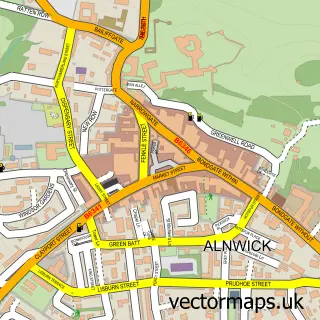
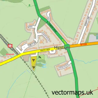
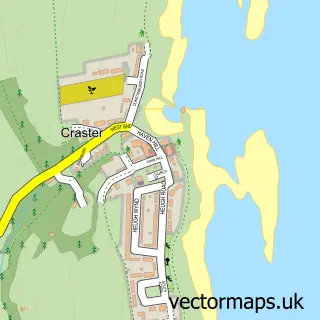
This Longhoughton street map is a detailed vector street map covering a 750m x 750m area. Select a larger area to create and download your own vector street map of Longhoughton.
The 750-metre map sample for Longhoughton covers 130 mapped buildings and approximately 19.1 km of road detail, of which 21 named roads are named. The immediate area includes 1 school. The wider area around Longhoughton features 2 tourism points of interest and 1 hotel. To create a larger or custom map of Longhoughton, the map builder lets you define your own coverage area and download editable SVG, PDF and PNG files.
Create a larger editable map of Longhoughton
Choose any area you need and generate a high-quality vector map instantly. Perfect for print, planning, design, business and personal use.

This Longhoughton street map in Northumberland is available as downloadable SVG, PDF and PNG map files, or as a printed map for planning, business, display, education, local information and design work. You can also create a larger custom map area using the map selector.
What this Longhoughton map sample shows
Longhoughton lies within Longhoughton Cp parish, part of Longhoughton ward in the Northumberland local authority area. The postcode geography for this area includes the NE postcode area, the NE66 postcode district and the NE66 3 postcode sector. Residents fall under the Nhs North East And North Cumbria Integrated Care Board for NHS services.
Local features near Longhoughton
Within 2 milesAmenities and services in and around Longhoughton.
Administrative and postcode information for Longhoughton
Longhoughton lies within Longhoughton Cp parish, part of Longhoughton ward in the Northumberland local authority area. The postcode geography for this area includes the NE postcode area, the NE66 postcode district and the NE66 3 postcode sector. Residents fall under the Nhs North East And North Cumbria Integrated Care Board for NHS services.
Nearby street map samples around Longhoughton

More street maps in Northumberland
750 metre map area coverage
Boundary, postcode and point of interest information for the 750m x 750m rectangle centred on this sample map.
Boundaries containing map centre
Constituency: North Northumberland Co Const
District: Northumberland
Icb: NHS North East and North Cumbria ICB
Parish: Longhoughton CP
Police Force: northumberland
Postcode District: NE66
Postcode Sector: NE66 3
Nearby boundaries intersecting sample
No additional intersecting boundaries found.
Postcode coverage
POI category counts
Community Center: 2
Elementary School: 2
Park: 2
Active Life: 1
Anglican Church: 1
Architectural Designer: 1
Atms: 1
Bakery: 1
Beauty Salon: 1
Bed And Breakfast: 1
Sample points of interest
- Rock Moor
- St Peter & St Paul, Longhoughton
- Westrak Ltd
- The Cooperative Food Longhoughton - Burnside, Longhoughton
- The Running Fox
- The Beauty Barn - Longhoughton
- Chestnut Tree House
- St Peter and St Paul's Church
- Longhoughton Community & Sports Centre
- Longhoughton Village Development Trust
- Co-op
- Evri ParcelShop
Create a larger editable map of Longhoughton
This sample shows only a 750 metre area. To create a larger map of Longhoughton, use our map builder to choose your own coverage area, add titles and download editable SVG, PDF and PNG files.
Create a custom map of Longhoughton