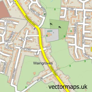
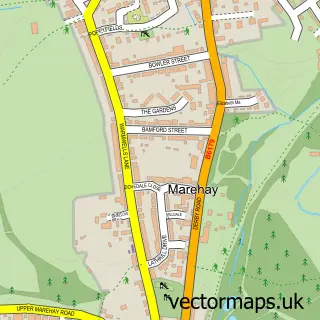
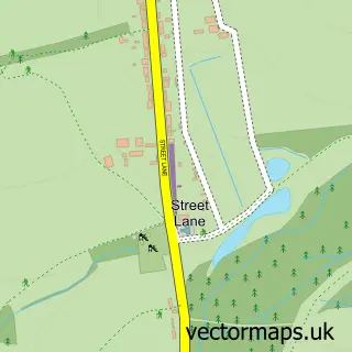
This Loscoe street map is a detailed vector street map covering a 750m x 750m area. Select a larger area to create and download your own vector street map of Loscoe.
The 750-metre map sample for Loscoe covers 452 mapped buildings and approximately 15.6 km of road detail, of which 22 named roads are named. The immediate area includes 5 GP surgeries within 2 miles, 1 pub and 18 MOT stations within 2 miles. The wider area around Loscoe features 2 tourism points of interest, 1 food and drink venue and 1 campsite within 2 miles. To create a larger or custom map of Loscoe, the map builder lets you define your own coverage area and download editable SVG, PDF and PNG files.
Create a larger editable map of Loscoe
Choose any area you need and generate a high-quality vector map instantly. Perfect for print, planning, design, business and personal use.

This Loscoe street map in Derbyshire is available as downloadable SVG, PDF and PNG map files, or as a printed map for planning, business, display, education, local information and design work. You can also create a larger custom map area using the map selector.
What this Loscoe map sample shows
Loscoe lies within Heanor And Loscoe Cp parish, part of Heanor And Loscoe ward in the Amber Valley District (B) local authority area. The postcode geography for this area includes the DE postcode area, the DE75 postcode district and the DE75 7 postcode sector. Residents fall under the Nhs Derby And Derbyshire Integrated Care Board for NHS services.
Local features near Loscoe
Within 2 milesAmenities and services in and around Loscoe.
Administrative and postcode information for Loscoe
Loscoe lies within Heanor And Loscoe Cp parish, part of Heanor And Loscoe ward in the Amber Valley District (B) local authority area. The postcode geography for this area includes the DE postcode area, the DE75 postcode district and the DE75 7 postcode sector. Residents fall under the Nhs Derby And Derbyshire Integrated Care Board for NHS services.
Nearby street map samples around Loscoe

More street maps in Derbyshire
750 metre map area coverage
Boundary, postcode and point of interest information for the 750m x 750m rectangle centred on this sample map.
Boundaries containing map centre
Constituency: Amber Valley Co Const
County: Derbyshire County
District: Amber Valley District (B)
Icb: NHS Derby and Derbyshire ICB
Parish: Heanor and Loscoe CP
Police Force: derbyshire
Postcode District: DE75
Postcode Sector: DE75 7
Ward: Heanor West & Loscoe Ward
Nearby boundaries intersecting sample
Parish: Codnor CP
Postcode District: DE5
Postcode Sector: DE5 9
Ward: Codnor, Langley Mill & Aldercar Ward
Postcode coverage
POI category counts
Bar: 3
Beauty Salon: 2
Landmark And Historical Building: 2
Banks: 1
Barber: 1
Brake Service And Repair: 1
Community Services Non Profits: 1
Construction Services: 1
Currency Exchange: 1
Dog Walkers: 1
Sample points of interest
- NatWest
- Gate Inn
- The Eclipse Bar
- The Gate Inn
- The Community Barber
- Katie Jane Beauty Therapy
- Too cuticle
- Motservicing Ltd.
- Loscoe Ladybirds Women's Institute
- Mawson Builders
- Post Office Travel Money
- Chloe's Walk and Wag
Create a larger editable map of Loscoe
This sample shows only a 750 metre area. To create a larger map of Loscoe, use our map builder to choose your own coverage area, add titles and download editable SVG, PDF and PNG files.
Create a custom map of Loscoe