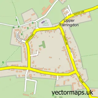
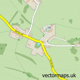
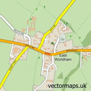
This Lower Farringdon street map is a detailed vector street map covering a 750m x 750m area. Select a larger area to create and download your own vector street map of Lower Farringdon.
The 750-metre map sample for Lower Farringdon covers 111 mapped buildings and approximately 9.4 km of road detail, of which 5 named roads are named. The immediate area includes 2 pubs and 2 MOT stations, with 3 within 2 miles. The wider area around Lower Farringdon features 2 food and drink venues. To create a larger or custom map of Lower Farringdon, the map builder lets you define your own coverage area and download editable SVG, PDF and PNG files.
Create a larger editable map of Lower Farringdon
Choose any area you need and generate a high-quality vector map instantly. Perfect for print, planning, design, business and personal use.

This Lower Farringdon street map in Hampshire is available as downloadable SVG, PDF and PNG map files, or as a printed map for planning, business, display, education, local information and design work. You can also create a larger custom map area using the map selector.
What this Lower Farringdon map sample shows
Lower Farringdon lies within Farringdon Cp parish, part of Binsted, Bentley & Selborne ward in the East Hampshire District local authority area. The postcode geography for this area includes the GU postcode area, the GU34 postcode district and the GU34 3 postcode sector. Residents fall under the Nhs Hampshire And Isle Of Wight Integrated Care Board for NHS services.
Local features near Lower Farringdon
Within 2 milesAmenities and services in and around Lower Farringdon.
Administrative and postcode information for Lower Farringdon
The local authority covering Lower Farringdon is East Hampshire District, within the county of Hampshire. The settlement lies within Binsted, Bentley & Selborne ward and Farringdon Cp civil parish. The GU34 postcode district and GU34 3 postcode sector serve the immediate area. NHS provision in the area is delivered through Hampshire Hospitals Nhs Foundation Trust.
Nearby street map samples around Lower Farringdon

More street maps in Hampshire
750 metre map area coverage
Boundary, postcode and point of interest information for the 750m x 750m rectangle centred on this sample map.
Boundaries containing map centre
Constituency: East Hampshire Co Const
County: Hampshire County
District: East Hampshire District
Icb: NHS Hampshire and Isle of Wight ICB
Parish: Farringdon CP
Police Force: hampshire
Postcode District: GU34
Postcode Sector: GU34 3
Ward: Binsted, Bentley & Selborne Ward
Nearby boundaries intersecting sample
No additional intersecting boundaries found.
Postcode coverage
POI category counts
Motorcycle Dealer: 3
Advertising Agency: 2
Business Manufacturing And Supply: 2
Pub: 2
Automotive: 1
Automotive Repair: 1
Bar: 1
Beach Equipment Rentals: 1
Bicycle Shop: 1
Business Management Services: 1
Sample points of interest
- Graphitech
- Orchard PR
- Froxfield Service Centre
- Alton Cars & Vans Ltd
- Farringdon Coffee Company
- Fence Hire (Southern) Ltd.
- Velolineuk
- Graphitech Signs & Graphics
- PF Modular
- The Country Candle Company
- Harrys Carpets
- Sean Doyle Scaffolding
Create a larger editable map of Lower Farringdon
This sample shows only a 750 metre area. To create a larger map of Lower Farringdon, use our map builder to choose your own coverage area, add titles and download editable SVG, PDF and PNG files.
Create a custom map of Lower Farringdon