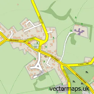
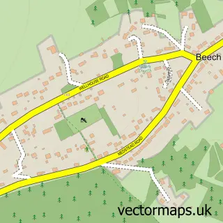
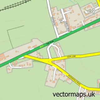
This Four Marks street map is a detailed vector street map covering a 750m x 750m area. Select a larger area to create and download your own vector street map of Four Marks.
The 750-metre map sample for Four Marks covers 519 mapped buildings and approximately 16.2 km of road detail, of which 36 named roads are named. The immediate area includes 1 railway station, 1 GP surgery, with 2 within 2 miles and 2 MOT stations within 2 miles. The wider area around Four Marks features 1 tourism point of interest and 4 food and drink venues. To create a larger or custom map of Four Marks, the map builder lets you define your own coverage area and download editable SVG, PDF and PNG files.
Create a larger editable map of Four Marks
Choose any area you need and generate a high-quality vector map instantly. Perfect for print, planning, design, business and personal use.

This Four Marks street map in Hampshire is available as downloadable SVG, PDF and PNG map files, or as a printed map for planning, business, display, education, local information and design work. You can also create a larger custom map area using the map selector.
What this Four Marks map sample shows
Four Marks lies within Four Marks Cp parish, part of Four Marks & Medstead ward in the East Hampshire District local authority area. The postcode geography for this area includes the GU postcode area, the GU34 postcode district and the GU34 5 postcode sector. Residents fall under the Nhs Hampshire And Isle Of Wight Integrated Care Board for NHS services.
Local features near Four Marks
Within 2 milesAmenities and services in and around Four Marks.
Administrative and postcode information for Four Marks
The local authority covering Four Marks is East Hampshire District, within the county of Hampshire. The settlement lies within Four Marks & Medstead ward and Four Marks Cp civil parish. The GU34 postcode district and GU34 5 postcode sector serve the immediate area. NHS provision in the area is delivered through Hampshire Hospitals Nhs Foundation Trust.
Nearby street map samples around Four Marks

More street maps in Hampshire
750 metre map area coverage
Boundary, postcode and point of interest information for the 750m x 750m rectangle centred on this sample map.
Boundaries containing map centre
Constituency: East Hampshire Co Const
County: Hampshire County
District: East Hampshire District
Icb: NHS Hampshire and Isle of Wight ICB
Parish: Four Marks CP
Police Force: hampshire
Postcode District: GU34
Postcode Sector: GU34 5
Ward: Four Marks & Medstead Ward
Nearby boundaries intersecting sample
Parish: Medstead CP
Postcode coverage
POI category counts
Professional Services: 4
Building Supply Store: 3
Convenience Store: 3
Gas Station: 3
It Service And Computer Repair: 3
Retail: 3
Advertising Agency: 2
Beverage Store: 2
Brewery: 2
Cafe: 2
Sample points of interest
- Midas Bookkeeping & Accountancy
- Four Marks Golf Club
- Avid Creative
- Caboodle Design
- Unifast Fastening Systems Limited
- BP Four Marks SF Connect
- Four Marks Hand Car Wash
- Silchester Control Systems
- M & S Mechanicals Ltd
- Loaf Bakery
- Faded Skulls
- First Impression
Create a larger editable map of Four Marks
This sample shows only a 750 metre area. To create a larger map of Four Marks, use our map builder to choose your own coverage area, add titles and download editable SVG, PDF and PNG files.
Create a custom map of Four Marks