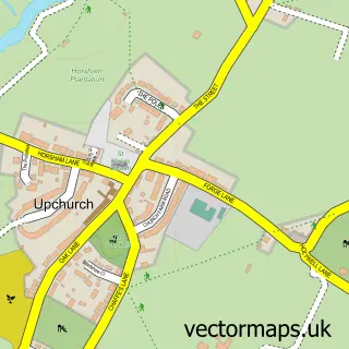
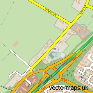
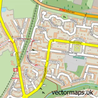
This Lower Halstow street map is a detailed vector street map covering a 750m x 750m area. Select a larger area to create and download your own vector street map of Lower Halstow.
The 750-metre map sample for Lower Halstow covers 289 mapped buildings and approximately 12.1 km of road detail, of which 14 named roads are named. The immediate area includes 1 school, 1 pub and 5 MOT stations within 2 miles. The wider area around Lower Halstow features 2 tourism points of interest and 1 food and drink venue. To create a larger or custom map of Lower Halstow, the map builder lets you define your own coverage area and download editable SVG, PDF and PNG files.
Create a larger editable map of Lower Halstow
Choose any area you need and generate a high-quality vector map instantly. Perfect for print, planning, design, business and personal use.

This Lower Halstow street map in Kent is available as downloadable SVG, PDF and PNG map files, or as a printed map for planning, business, display, education, local information and design work. You can also create a larger custom map area using the map selector.
What this Lower Halstow map sample shows
Lower Halstow lies within Lower Halstow Cp parish, part of Bobbing, Iwade And Lower Halstow ward in the Swale District (B) local authority area. The postcode geography for this area includes the ME postcode area, the ME9 postcode district and the ME9 7 postcode sector. Residents fall under the Nhs Kent And Medway Integrated Care Board for NHS services.
Local features near Lower Halstow
Within 2 milesAmenities and services in and around Lower Halstow.
Administrative and postcode information for Lower Halstow
Lower Halstow lies within Lower Halstow Cp parish, part of Bobbing, Iwade And Lower Halstow ward in the Swale District (B) local authority area. The postcode geography for this area includes the ME postcode area, the ME9 postcode district and the ME9 7 postcode sector. Residents fall under the Nhs Kent And Medway Integrated Care Board for NHS services.
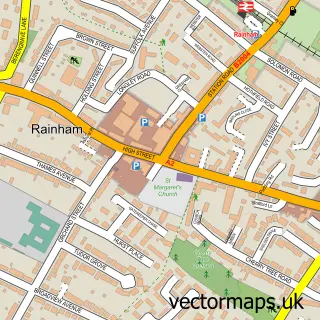
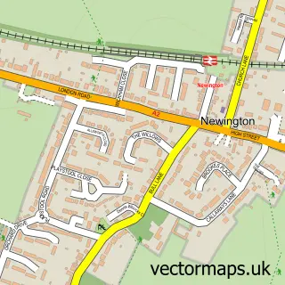
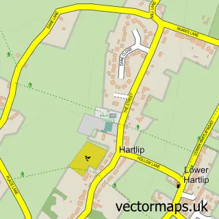
Nearby street map samples around Lower Halstow

More street maps in Kent
750 metre map area coverage
Boundary, postcode and point of interest information for the 750m x 750m rectangle centred on this sample map.
Boundaries containing map centre
Constituency: Sittingbourne and Sheppey Co Const
County: Kent County
District: Swale District (B)
Icb: NHS Kent and Medway ICB
Parish: Lower Halstow CP
Police Force: kent
Postcode District: ME9
Postcode Sector: ME9 7
Ward: Bobbing, Iwade and Lower Halstow Ward
Nearby boundaries intersecting sample
Parish: Upchurch CP
Ward: Hartlip, Newington and Upchurch Ward
Postcode coverage
POI category counts
Elementary School: 3
Web Designer: 2
Anglican Church: 1
Arts And Entertainment: 1
Attractions And Activities: 1
Bed And Breakfast: 1
Church Cathedral: 1
Community Center: 1
Convenience Store: 1
Dance School: 1
Sample points of interest
- St Margaret of Antioch Lower Halstow
- Steve Gee
- The Brickfields
- Green Farmhouse
- Lower Halstow Church
- Lower Halstow Memorial Hall
- Best-one
- The Edge Studios
- BJL Electrical
- Lower Halstow Primary School
- Lower Halstow Primary School
- Newington C of E Primary School
Create a larger editable map of Lower Halstow
This sample shows only a 750 metre area. To create a larger map of Lower Halstow, use our map builder to choose your own coverage area, add titles and download editable SVG, PDF and PNG files.
Create a custom map of Lower Halstow