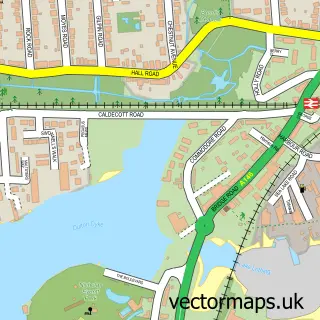
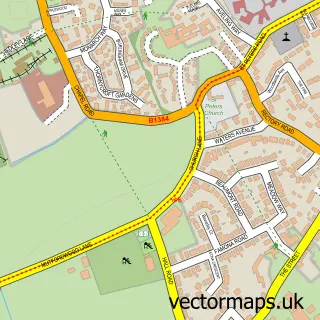
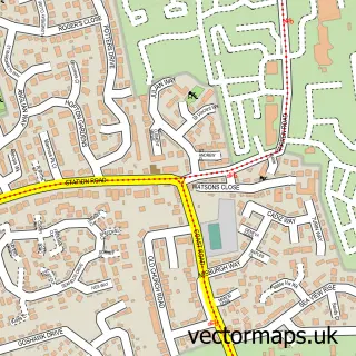
This Lowestoft street map is a detailed vector street map covering a 750m x 750m area. Select a larger area to create and download your own vector street map of Lowestoft.
The 750-metre map sample for Lowestoft covers 211 mapped buildings and approximately 23.0 km of road detail, of which 51 named roads are named. The immediate area includes 1 school, 1 railway station, 5 GP surgeries within 2 miles and 8 pubs among other local services. The wider area around Lowestoft features 1 tourism point of interest and 31 food and drink venues. To create a larger or custom map of Lowestoft, the map builder lets you define your own coverage area and download editable SVG, PDF and PNG files.
Create a larger editable map of Lowestoft
Choose any area you need and generate a high-quality vector map instantly. Perfect for print, planning, design, business and personal use.

This Lowestoft street map in Suffolk is available as downloadable SVG, PDF and PNG map files, or as a printed map for planning, business, display, education, local information and design work. You can also create a larger custom map area using the map selector.
What this Lowestoft map sample shows
Lowestoft lies within Lowestoft Cp parish, part of Harbour & Normanston ward in the East Suffolk District local authority area. The postcode geography for this area includes the NR postcode area, the NR32 postcode district and the NR32 2 postcode sector. Residents fall under the Nhs Norfolk And Waveney Integrated Care Board for NHS services.
Local features near Lowestoft
Within 2 milesAmenities and services in and around Lowestoft.
Administrative and postcode information for Lowestoft
The local authority covering Lowestoft is East Suffolk District, within the county of Suffolk. The settlement lies within Harbour & Normanston ward and Lowestoft Cp civil parish. The NR32 postcode district and NR32 2 postcode sector serve the immediate area. NHS provision in the area is delivered through James Paget University Hospitals Nhs Foundation Trust.
Nearby street map samples around Lowestoft

More street maps in Suffolk
750 metre map area coverage
Boundary, postcode and point of interest information for the 750m x 750m rectangle centred on this sample map.
Boundaries containing map centre
Constituency: Lowestoft Co Const
County: Suffolk County
District: East Suffolk District
Icb: NHS Norfolk and Waveney ICB
Parish: Lowestoft CP
Police Force: suffolk
Postcode District: NR32
Postcode Sector: NR32 1
Ward: Harbour & Normanston Ward
Nearby boundaries intersecting sample
Postcode Sector: NR32 2
Postcode coverage
POI category counts
Cafe: 13
Professional Services: 13
Clothing Store: 12
Charity Organization: 11
Discount Store: 11
Automotive Repair: 10
Barber: 10
Hair Salon: 10
Real Estate Agent: 9
Beauty Salon: 8
Sample points of interest
- Accountancy Solutions (MBC) Ltd.
- P Lacey & Associates
- Tubbs Sons Giles & Co.
- Dr Ying Chinese Medical Centre
- Graphitas
- Ipsos Mori
- Martin Hailes Design Ltd
- Red Hot Media
- Christ Church Lowestoft
- Beatty Lockey Antiques
- The Salvation Army Charity Shop
- Singer Sewing Centre
Create a larger editable map of Lowestoft
This sample shows only a 750 metre area. To create a larger map of Lowestoft, use our map builder to choose your own coverage area, add titles and download editable SVG, PDF and PNG files.
Create a custom map of Lowestoft