Vector Maps logo
Home Why it works Popular maps Districts Samples Customizer Create Your Map
VectorMaps.uk
Home Popular maps Districts Samples Customizer Create Your Map Privacy Disclaimer
Home / UK Maps / Cheshire / Lymm Map

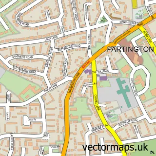
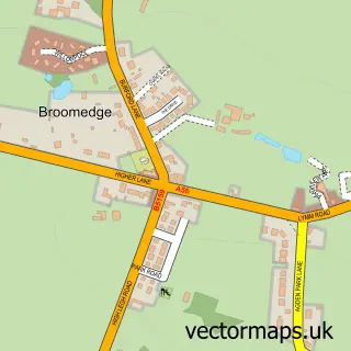
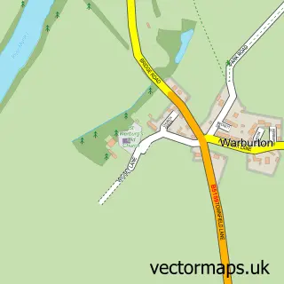
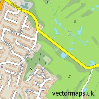
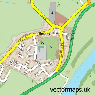
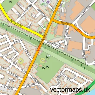
This Lymm street map is a detailed vector street map covering a 750m x 750m area. Select a larger area to create and download your own vector street map of Lymm.

Lymm is a village in Cheshire, in the North West of England. The settlement falls within the Warrington South parliamentary constituency. It is served by the WA13 postcode district, with WA13 0 as the local postcode sector.

The 750-metre map sample for Lymm covers 441 mapped buildings and approximately 18.5 km of road detail, of which 50 named roads are named. The immediate area includes 1 GP surgery, with 2 within 2 miles, 8 pubs and 4 MOT stations within 2 miles. The wider area around Lymm features 4 tourism points of interest, 17 food and drink venues and 1 hotel. To create a larger or custom map of Lymm, the map builder lets you define your own coverage area and download editable SVG, PDF and PNG files.

441Buildings
18.52 kmRoads
50Named roads
5,889Residents within 2 miles
Create your own

Create a larger editable map of Lymm

Choose any area you need and generate a high-quality vector map instantly. Perfect for print, planning, design, business and personal use.

Choose any location
Editable SVG files
Any size up to A0
PDF, PNG & more
Instant download
High quality guaranteed
Create My Custom Map
Secure, private & no credit card required
Lymm Vector Street Map
750m Sample
Lymm vector street map sample showing roads, buildings and local features in a 750 metre preview area
Buy Lymm Map Print from £12.95 Buy Lymm Digital Map from £6

This Lymm street map in Cheshire is available as downloadable SVG, PDF and PNG map files, or as a printed map for planning, business, display, education, local information and design work. You can also create a larger custom map area using the map selector.

What this Lymm map sample shows

Lymm lies within Lymm Cp parish, part of Lymm South ward in the Warrington (B) local authority area. The postcode geography for this area includes the WA postcode area, the WA13 postcode district and the WA13 0 postcode sector. Residents fall under the Nhs Cheshire And Merseyside Integrated Care Board for NHS services.

Local features near Lymm

Within 2 miles

Amenities and services in and around Lymm.

1 GP surgeries 2 within 2 miles
4 MOT stations within 2 miles
4 Tourism & leisure
17 Food & drink
8 Pubs
1 Hotels
7 Healthcare POIs
1 Vehicle services

Counts are approximate and based on publicly available data.

Administrative and postcode information for Lymm

Lymm lies within Lymm Cp parish, part of Lymm South ward in the Warrington (B) local authority area. The postcode geography for this area includes the WA postcode area, the WA13 postcode district and the WA13 0 postcode sector. Residents fall under the Nhs Cheshire And Merseyside Integrated Care Board for NHS services.

Parish Lymm CP
Ward Lymm South
District / local authority Warrington (B)
County Cheshire
Historic county Cheshire
Postcode district WA13
Postcode sector WA13 0
Parliamentary constituency Warrington South
Region North West
Country England

Nearby street map samples around Lymm

Street map sample of Partington, Greater Manchester Partington Town - Greater Manchester - 3.2 miles Street map sample of Salford, Greater Manchester Salford City - Greater Manchester - 10.7 miles Street map sample of Broomedge, Cheshire Broomedge Village - Cheshire - 1.5 miles Street map sample of Warburton, Greater Manchester Warburton Village - Greater Manchester - 1.7 miles Street map sample of High Legh, Cheshire High Legh Village - Cheshire - 2.3 miles Street map sample of Hollins Green, Cheshire Hollins Green Village - Cheshire - 2.4 miles Street map sample of Glazebrook, Cheshire Glazebrook Village - Cheshire - 3.1 miles Street map sample of Appleton Thorn, Cheshire Appleton Thorn Village - Cheshire - 3.5 miles Street map sample of Dunham Town, Greater Manchester Dunham Town Village - Greater Manchester - 3.5 miles Street map sample of Cadishead, Greater Manchester Cadishead Village - Greater Manchester - 3.6 miles

More street maps in Cheshire

Street map sample of Broomedge, Cheshire Broomedge Village - 1.5 miles Street map sample of High Legh, Cheshire High Legh Village - 2.3 miles Street map sample of Hollins Green, Cheshire Hollins Green Village - 2.4 miles Street map sample of Glazebrook, Cheshire Glazebrook Village - 3.1 miles Street map sample of Appleton Thorn, Cheshire Appleton Thorn Village - 3.5 miles

750 metre map area coverage

Boundary, postcode and point of interest information for the 750m x 750m rectangle centred on this sample map.

Boundaries containing map centre

Constituency: Tatton Co Const

District: Warrington (B)

Icb: NHS Cheshire and Merseyside ICB

Parish: Lymm CP

Police Force: cheshire

Postcode District: WA13

Postcode Sector: WA13 0

Ward: Lymm South Ward

Nearby boundaries intersecting sample

Postcode Sector: WA13 9

Ward: Lymm North & Thelwall Ward

Postcode coverage

WA13 WA13 0 WA13 9

POI category counts

Real Estate Agent: 9

Pub: 8

Professional Services: 7

Hair Salon: 6

Bar: 5

Cafe: 5

Advertising Agency: 4

Art Gallery: 4

Barber: 4

Beauty Salon: 4

Sample points of interest

  • Bridgewater Canal Lymm Active Life
  • Lymm Canalside Active Life
  • Double D Creative Advertising Agency
  • Kimwetu Advertising Agency
  • Stratia Advertising Agency
  • The Pixel Bullies Advertising Agency
  • Lymm Travel Airport Shuttles
  • CB3 Development Ltd. Architect
  • Blackmore Gallery Art Gallery
  • CLK Art Art Gallery
  • Collect Art Art Gallery
  • Collect Art Art Gallery

Create a larger editable map of Lymm

This sample shows only a 750 metre area. To create a larger map of Lymm, use our map builder to choose your own coverage area, add titles and download editable SVG, PDF and PNG files.

Create a custom map of Lymm

Phone 01751 473136 | Copyright Vectormaps.uk 2026

Samples Customizer Privacy Disclaimer
Lymm Vector Street Map
Lymm enlarged street map sample showing a 750 metre preview area