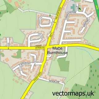
This Maenporth street map is a detailed vector street map covering a 750m x 750m area. Select a larger area to create and download your own vector street map of Maenporth.
The 750-metre map sample for Maenporth covers 81 mapped buildings and approximately 5.0 km of road detail, of which 2 named roads are named. The immediate area includes 1 GP surgery within 2 miles and 2 MOT stations within 2 miles. The wider area around Maenporth features 1 food and drink venue, 4 hotels and 3 campsites within 2 miles. To create a larger or custom map of Maenporth, the map builder lets you define your own coverage area and download editable SVG, PDF and PNG files.
Create a larger editable map of Maenporth
Choose any area you need and generate a high-quality vector map instantly. Perfect for print, planning, design, business and personal use.

This Maenporth street map in Cornwall is available as downloadable SVG, PDF and PNG map files, or as a printed map for planning, business, display, education, local information and design work. You can also create a larger custom map area using the map selector.
What this Maenporth map sample shows
Maenporth lies within Mawnan Cp parish, part of Constantine, Mawnan And Budock ward in the Cornwall local authority area. The postcode geography for this area includes the TR postcode area, the TR11 postcode district and the TR11 5 postcode sector. Residents fall under the Nhs Cornwall And The Isles Of Scilly Integrated Care Board for NHS services.
Local features near Maenporth
Within 2 milesAmenities and services in and around Maenporth.
Administrative and postcode information for Maenporth
The local authority covering Maenporth is Cornwall, within the county of Cornwall. The settlement lies within Constantine, Mawnan And Budock ward and Mawnan Cp civil parish. The TR11 postcode district and TR11 5 postcode sector serve the immediate area. NHS provision in the area is delivered through Royal Cornwall Hospitals Nhs Trust.
Nearby street map samples around Maenporth

More street maps in Cornwall
750 metre map area coverage
Boundary, postcode and point of interest information for the 750m x 750m rectangle centred on this sample map.
Boundaries containing map centre
Constituency: Camborne and Redruth Co Const
District: Cornwall
Icb: NHS Cornwall and the Isles of Scilly ICB
Parish: Mawnan CP
Police Force: devon and cornwall
Postcode District: TR11
Postcode Sector: TR11 5
Nearby boundaries intersecting sample
Constituency: Truro and Falmouth Co Const
Parish: Budock CP, Falmouth CP
Postcode coverage
POI category counts
Hotel: 4
Architect: 1
Arts And Crafts: 1
Beach: 1
Electrician: 1
Elementary School: 1
Holiday Rental Home: 1
Pet Boarding: 1
Resort: 1
Restaurant: 1
Sample points of interest
- Ajc Architecture
- The Cornish Seagull Company
- Maenporth Beach
- Maenporth Electrical Ltd
- Mawnan C of E Primary School
- Maenporth Estate
- Avalon Guest House
- Avalon Guest House
- Tregedna Farm Holidays
- Tregedna Farm Weddings & Events
- Cornish Holiday Cottages
- Maenporth Estate
Create a larger editable map of Maenporth
This sample shows only a 750 metre area. To create a larger map of Maenporth, use our map builder to choose your own coverage area, add titles and download editable SVG, PDF and PNG files.
Create a custom map of Maenporth