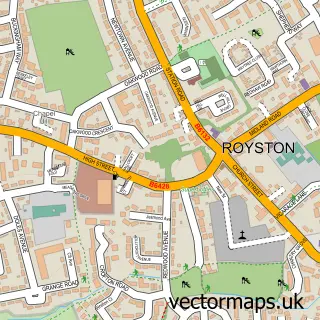
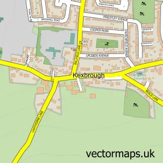
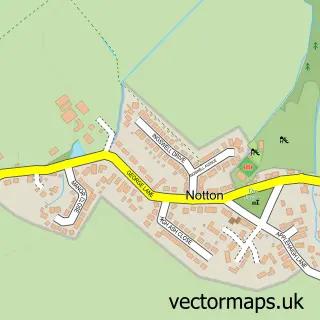
This Mapplewell street map is a detailed vector street map covering a 750m x 750m area. Select a larger area to create and download your own vector street map of Mapplewell.
The 750-metre map sample for Mapplewell covers 657 mapped buildings and approximately 20.1 km of road detail, of which 47 named roads are named. The immediate area includes 1 school, 1 GP surgery, with 3 within 2 miles, 6 pubs and 12 MOT stations within 2 miles. The wider area around Mapplewell features 1 tourism point of interest and 8 food and drink venues. To create a larger or custom map of Mapplewell, the map builder lets you define your own coverage area and download editable SVG, PDF and PNG files.
Create a larger editable map of Mapplewell
Choose any area you need and generate a high-quality vector map instantly. Perfect for print, planning, design, business and personal use.

This Mapplewell street map in South Yorkshire is available as downloadable SVG, PDF and PNG map files, or as a printed map for planning, business, display, education, local information and design work. You can also create a larger custom map area using the map selector.
What this Mapplewell map sample shows
Mapplewell lies within Barnsley District (B) parish, part of Darton East ward in the Barnsley District (B) local authority area. The postcode geography for this area includes the S postcode area, the S75 postcode district and the S75 6 postcode sector. Residents fall under the Nhs South Yorkshire Integrated Care Board for NHS services.
Local features near Mapplewell
Within 2 milesAmenities and services in and around Mapplewell.
Administrative and postcode information for Mapplewell
Mapplewell lies within Barnsley District (B) parish, part of Darton East ward in the Barnsley District (B) local authority area. The postcode geography for this area includes the S postcode area, the S75 postcode district and the S75 6 postcode sector. Residents fall under the Nhs South Yorkshire Integrated Care Board for NHS services.
Nearby street map samples around Mapplewell

More street maps in South Yorkshire
750 metre map area coverage
Boundary, postcode and point of interest information for the 750m x 750m rectangle centred on this sample map.
Boundaries containing map centre
Constituency: Barnsley North Co Const
District: Barnsley District (B)
Icb: NHS South Yorkshire ICB
Police Force: south yorkshire
Postcode District: S75
Postcode Sector: S75 6
Ward: Darton East Ward
Nearby boundaries intersecting sample
Postcode Sector: S75 1, S75 5
Postcode coverage
POI category counts
Hair Salon: 9
Beauty Salon: 7
Pub: 6
Convenience Store: 5
Professional Services: 5
Retirement Home: 4
Assisted Living Facility: 3
Automotive Repair: 3
Bakery: 3
Bar: 3
Sample points of interest
- AIMS Accountants for Business
- Oh Sew Sweet Shop
- Ruby Open Kitchen
- Barnsley Ruby Open Kitchen
- Chapel View Nursing Home
- Deangate Care Home
- Deangate Care Home
- Metro Stores, Mapplewell
- Yorkshire Building Society
- Royale Alloys
- Autosound
- Leisure Vehicle Maintenance
Create a larger editable map of Mapplewell
This sample shows only a 750 metre area. To create a larger map of Mapplewell, use our map builder to choose your own coverage area, add titles and download editable SVG, PDF and PNG files.
Create a custom map of Mapplewell