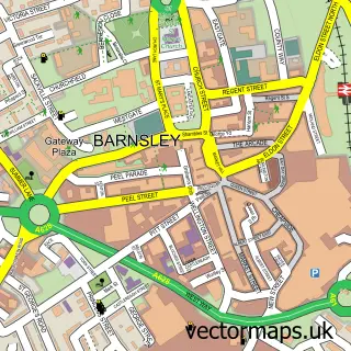
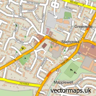
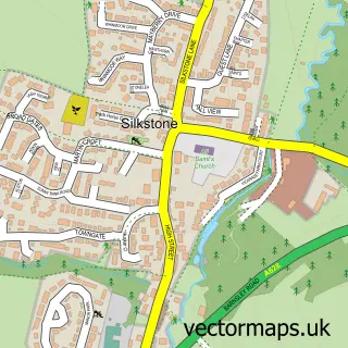
This Barugh Green street map is a detailed vector street map covering a 750m x 750m area. Select a larger area to create and download your own vector street map of Barugh Green.
The 750-metre map sample for Barugh Green covers 423 mapped buildings and approximately 11.2 km of road detail, of which 26 named roads are named. The immediate area includes 1 school, 4 GP surgeries within 2 miles, 1 pub and 12 MOT stations within 2 miles. The wider area around Barugh Green features 1 tourism point of interest and 1 food and drink venue. To create a larger or custom map of Barugh Green, the map builder lets you define your own coverage area and download editable SVG, PDF and PNG files.
Create a larger editable map of Barugh Green
Choose any area you need and generate a high-quality vector map instantly. Perfect for print, planning, design, business and personal use.

This Barugh Green street map in South Yorkshire is available as downloadable SVG, PDF and PNG map files, or as a printed map for planning, business, display, education, local information and design work. You can also create a larger custom map area using the map selector.
What this Barugh Green map sample shows
Barugh Green lies within Barnsley District (B) parish, part of Dodworth ward in the Barnsley District (B) local authority area. The postcode geography for this area includes the S postcode area, the S75 postcode district and the S75 2 postcode sector. Residents fall under the Nhs South Yorkshire Integrated Care Board for NHS services.
Local features near Barugh Green
Within 2 milesAmenities and services in and around Barugh Green.
Administrative and postcode information for Barugh Green
The local authority covering Barugh Green is Barnsley District (B), within the county of South Yorkshire. The settlement lies within Dodworth ward and Barnsley District (B) civil parish. The S75 postcode district and S75 2 postcode sector serve the immediate area. NHS provision in the area is delivered through Barnsley Hospital Nhs Foundation Trust.
Nearby street map samples around Barugh Green

More street maps in South Yorkshire
750 metre map area coverage
Boundary, postcode and point of interest information for the 750m x 750m rectangle centred on this sample map.
Boundaries containing map centre
Constituency: Barnsley North Co Const
District: Barnsley District (B)
Icb: NHS South Yorkshire ICB
Police Force: south yorkshire
Postcode District: S75
Postcode Sector: S75 1
Ward: Darton West Ward
Nearby boundaries intersecting sample
Constituency: Penistone and Stocksbridge Co Const
Ward: Dodworth Ward
Postcode coverage
POI category counts
Beauty Salon: 4
Roofing: 4
Clothing Store: 3
Building Supply Store: 2
Childrens Clothing Store: 2
Contractor: 2
Dance School: 2
Elementary School: 2
Furniture Store: 2
Key And Locksmith: 2
Sample points of interest
- Bookkeepers Direct
- Jump Zone
- K C Fibre Glass
- Mechanics HQ - Barnsley
- Deb's Barbers
- Bad&Boujee
- Ellie Firth Hair & Beauty
- Hair design and beauty studio
- Nails By Paige Rebeccaa
- The Crown & Anchor
- Oates Roofing
- Otm Developments
Create a larger editable map of Barugh Green
This sample shows only a 750 metre area. To create a larger map of Barugh Green, use our map builder to choose your own coverage area, add titles and download editable SVG, PDF and PNG files.
Create a custom map of Barugh Green