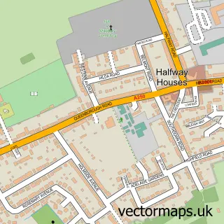
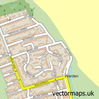
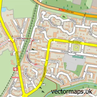
This Minster street map is a detailed vector street map covering a 750m x 750m area. Select a larger area to create and download your own vector street map of Minster.
The 750-metre map sample for Minster covers 553 mapped buildings and approximately 14.7 km of road detail, of which 36 named roads are named. The immediate area includes 1 school, 1 pub and 5 MOT stations within 2 miles. The wider area around Minster features 1 tourism point of interest, 3 food and drink venues and 1 hotel. To create a larger or custom map of Minster, the map builder lets you define your own coverage area and download editable SVG, PDF and PNG files.
Create a larger editable map of Minster
Choose any area you need and generate a high-quality vector map instantly. Perfect for print, planning, design, business and personal use.

This Minster street map in Kent is available as downloadable SVG, PDF and PNG map files, or as a printed map for planning, business, display, education, local information and design work. You can also create a larger custom map area using the map selector.
What this Minster map sample shows
Minster lies within Minster-On-Sea Cp parish, part of Sheppey Central ward in the Swale District (B) local authority area. The postcode geography for this area includes the ME postcode area, the ME12 postcode district and the ME12 3 postcode sector. Residents fall under the Nhs Kent And Medway Integrated Care Board for NHS services.
Local features near Minster
Within 2 milesAmenities and services in and around Minster.
Administrative and postcode information for Minster
The local authority covering Minster is Swale District (B), within the county of Kent. The settlement lies within Sheppey Central ward and Minster-On-Sea Cp civil parish. The ME12 postcode district and ME12 3 postcode sector serve the immediate area. NHS provision in the area is delivered through Medway Nhs Foundation Trust.
Nearby street map samples around Minster

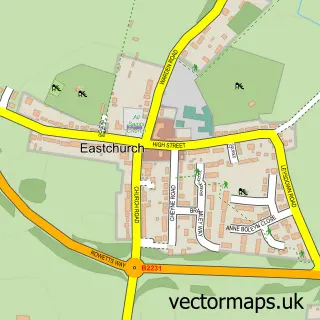
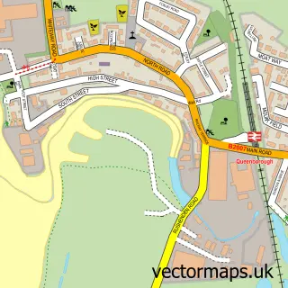
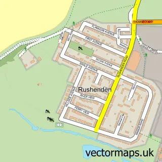
More street maps in Kent
750 metre map area coverage
Boundary, postcode and point of interest information for the 750m x 750m rectangle centred on this sample map.
Boundaries containing map centre
Constituency: Sittingbourne and Sheppey Co Const
County: Kent County
District: Swale District (B)
Icb: NHS Kent and Medway ICB
Parish: Minster-on-Sea CP
Police Force: kent
Postcode District: ME12
Postcode Sector: ME12 3
Ward: Sheppey Central Ward
Nearby boundaries intersecting sample
Postcode Sector: ME12 2
Ward: Minster Cliffs Ward
Postcode coverage
POI category counts
Church Cathedral: 3
Convenience Store: 3
Building Supply Store: 2
Elementary School: 2
Hair Salon: 2
Health And Medical: 2
Pet Services: 2
Social Service Organizations: 2
Advertising Agency: 1
Anglican Church: 1
Sample points of interest
- Leapfrog Logos
- St Mary & St Sexburga
- The Cooperative Food Minster (SWAP), Minster on Sea
- The Abbey Cake Shop
- The Prince of Waterloo
- Snippets
- Banks Bed & Breakfast
- Bloomin Gardening Services
- Grandview Gardens
- Sealine Taxis
- Wayside Caravan Park
- Island Ministries
Create a larger editable map of Minster
This sample shows only a 750 metre area. To create a larger map of Minster, use our map builder to choose your own coverage area, add titles and download editable SVG, PDF and PNG files.
Create a custom map of Minster