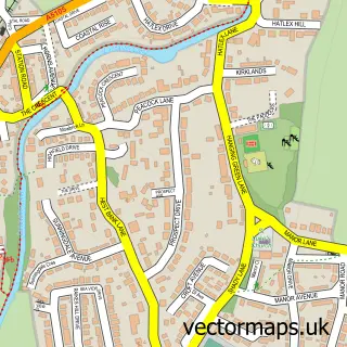
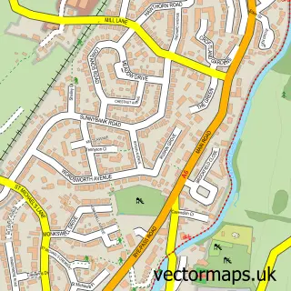
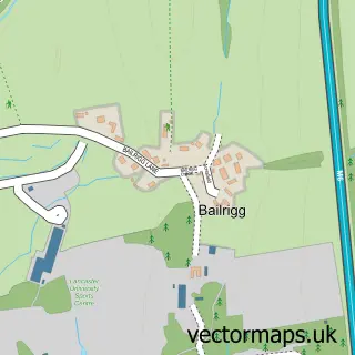
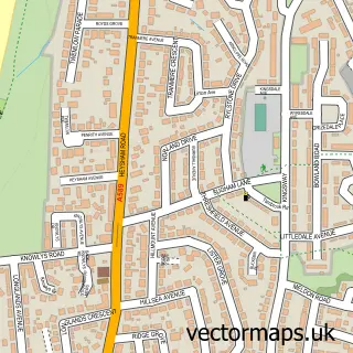
This Morecambe street map is a detailed vector street map covering a 750m x 750m area. Select a larger area to create and download your own vector street map of Morecambe.
The 750-metre map sample for Morecambe covers 290 mapped buildings and approximately 24.5 km of road detail, of which 69 named roads are named. The immediate area includes 1 school, 1 railway station, 15 pubs and 15 MOT stations within 2 miles. The wider area around Morecambe features 3 tourism points of interest, 47 food and drink venues and 16 hotels. To create a larger or custom map of Morecambe, the map builder lets you define your own coverage area and download editable SVG, PDF and PNG files.
Create a larger editable map of Morecambe
Choose any area you need and generate a high-quality vector map instantly. Perfect for print, planning, design, business and personal use.

This Morecambe street map in Lancashire is available as downloadable SVG, PDF and PNG map files, or as a printed map for planning, business, display, education, local information and design work. You can also create a larger custom map area using the map selector.
What this Morecambe map sample shows
Morecambe lies within Morecambe Cp parish, part of Poulton ward in the Lancaster District (B) local authority area. The postcode geography for this area includes the LA postcode area, the LA4 postcode district and the LA4 4 postcode sector. Residents fall under the Nhs Lancashire And South Cumbria Integrated Care Board for NHS services.
Local features near Morecambe
Within 2 milesAmenities and services in and around Morecambe.
Administrative and postcode information for Morecambe
Morecambe lies within Morecambe Cp parish, part of Poulton ward in the Lancaster District (B) local authority area. The postcode geography for this area includes the LA postcode area, the LA4 postcode district and the LA4 4 postcode sector. Residents fall under the Nhs Lancashire And South Cumbria Integrated Care Board for NHS services.
Nearby street map samples around Morecambe

More street maps in Lancashire
750 metre map area coverage
Boundary, postcode and point of interest information for the 750m x 750m rectangle centred on this sample map.
Boundaries containing map centre
Constituency: Morecambe and Lunesdale Co Const
County: Lancashire County
District: Lancaster District (B)
Icb: NHS Lancashire and South Cumbria ICB
Parish: Morecambe CP
Police Force: lancashire
Postcode District: LA4
Postcode Sector: LA4 5
Ward: Poulton Ward
Nearby boundaries intersecting sample
Postcode Sector: LA4 4
Ward: West End Ward
Postcode coverage
POI category counts
Beauty Salon: 22
Hotel: 16
Pub: 15
Restaurant: 13
Bar: 11
Tattoo And Piercing: 11
Cafe: 10
Hair Salon: 10
Banks: 9
Barber: 9
Sample points of interest
- AA Bookkeeping, Payroll And Business Support
- Laser Skate Shop
- Green Circles
- Search First Direct
- Social Link Up
- Flow Therapies
- CJ's All American diner
- Coopers Amusements
- EdenNorth
- British Red Cross
- Cancer Research
- Society • Antiques + Decorative
Create a larger editable map of Morecambe
This sample shows only a 750 metre area. To create a larger map of Morecambe, use our map builder to choose your own coverage area, add titles and download editable SVG, PDF and PNG files.
Create a custom map of Morecambe