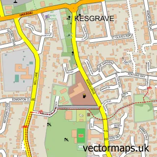
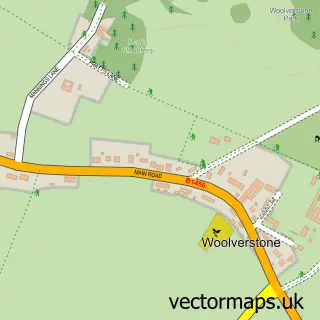
This Nacton street map is a detailed vector street map covering a 750m x 750m area. Select a larger area to create and download your own vector street map of Nacton.
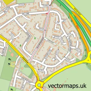
The 750-metre map sample for Nacton covers 153 mapped buildings and approximately 8.6 km of road detail, of which 8 named roads are named. The immediate area includes 1 school, 1 GP surgery within 2 miles and 12 MOT stations within 2 miles. To create a larger or custom map of Nacton, the map builder lets you define your own coverage area and download editable SVG, PDF and PNG files.
Create a larger editable map of Nacton
Choose any area you need and generate a high-quality vector map instantly. Perfect for print, planning, design, business and personal use.

This Nacton street map in Suffolk is available as downloadable SVG, PDF and PNG map files, or as a printed map for planning, business, display, education, local information and design work. You can also create a larger custom map area using the map selector.
What this Nacton map sample shows
Nacton lies within Nacton Cp parish, part of Orwell & Villages ward in the East Suffolk District local authority area. The postcode geography for this area includes the IP postcode area, the IP10 postcode district and the IP10 0 postcode sector. Residents fall under the Nhs Suffolk And North East Essex Integrated Care Board for NHS services.
Local features near Nacton
Within 2 milesAmenities and services in and around Nacton.
Administrative and postcode information for Nacton
The local authority covering Nacton is East Suffolk District, within the county of Suffolk. The settlement lies within Orwell & Villages ward and Nacton Cp civil parish. The IP10 postcode district and IP10 0 postcode sector serve the immediate area. NHS provision in the area is delivered through East Suffolk And North Essex Nhs Foundation Trust.
Nearby street map samples around Nacton

More street maps in Suffolk
750 metre map area coverage
Boundary, postcode and point of interest information for the 750m x 750m rectangle centred on this sample map.
Boundaries containing map centre
Constituency: Suffolk Coastal Co Const
County: Suffolk County
District: East Suffolk District
Icb: NHS Essex ICB
Parish: Nacton CP
Police Force: suffolk
Postcode District: IP10
Postcode Sector: IP10 0
Ward: Orwell & Villages Ward
Nearby boundaries intersecting sample
No additional intersecting boundaries found.
Postcode coverage
POI category counts
Business Management Services: 2
Elementary School: 2
Freight And Cargo Service: 2
Post Office: 2
Professional Services: 2
Accountant: 1
Advertising Agency: 1
Auto Loan Provider: 1
Business: 1
Community Center: 1
Sample points of interest
- Suzanne Lock Business Services
- Pyxis Media
- Suffolk Mortgages
- 7 Essential
- Electric Ink
- Print It
- Nacton Village Hall
- I Analysis Ltd.
- Nacton C of E VC Primary School
- Nacton Church of England Primary School
- Home Farm Nacton
- Alpha Omega Independent Financial Advisers
Create a larger editable map of Nacton
This sample shows only a 750 metre area. To create a larger map of Nacton, use our map builder to choose your own coverage area, add titles and download editable SVG, PDF and PNG files.
Create a custom map of Nacton