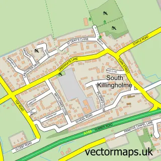
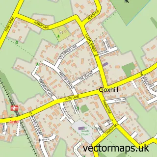
This North Killingholme street map is a detailed vector street map covering a 750m x 750m area. Select a larger area to create and download your own vector street map of North Killingholme.
The 750-metre map sample for North Killingholme covers 132 mapped buildings and approximately 7.5 km of road detail, of which 7 named roads are named. The immediate area includes 1 GP surgery within 2 miles and 1 MOT station within 2 miles. The wider area around North Killingholme features 2 hotels. To create a larger or custom map of North Killingholme, the map builder lets you define your own coverage area and download editable SVG, PDF and PNG files.
Create a larger editable map of North Killingholme
Choose any area you need and generate a high-quality vector map instantly. Perfect for print, planning, design, business and personal use.

This North Killingholme street map in Lincolnshire is available as downloadable SVG, PDF and PNG map files, or as a printed map for planning, business, display, education, local information and design work. You can also create a larger custom map area using the map selector.
What this North Killingholme map sample shows
North Killingholme lies within North Killingholme Cp parish, part of Ferry ward in the North Lincolnshire (B) local authority area. The postcode geography for this area includes the DN postcode area, the DN40 postcode district and the DN40 3 postcode sector. Residents fall under the Nhs Humber And North Yorkshire Integrated Care Board for NHS services.
Local features near North Killingholme
Within 2 milesAmenities and services in and around North Killingholme.
Administrative and postcode information for North Killingholme
The local authority covering North Killingholme is North Lincolnshire (B), within the county of Lincolnshire. The settlement lies within Ferry ward and North Killingholme Cp civil parish. The DN40 postcode district and DN40 3 postcode sector serve the immediate area. NHS provision in the area is delivered through Northern Lincolnshire And Goole Nhs Foundation Trust.
Nearby street map samples around North Killingholme

More street maps in Lincolnshire
750 metre map area coverage
Boundary, postcode and point of interest information for the 750m x 750m rectangle centred on this sample map.
Boundaries containing map centre
Constituency: Brigg and Immingham Co Const
District: North Lincolnshire (B)
Icb: NHS Humber and North Yorkshire ICB
Parish: North Killingholme CP
Police Force: humberside
Postcode District: DN40
Postcode Sector: DN40 3
Ward: Ferry Ward
Nearby boundaries intersecting sample
No additional intersecting boundaries found.
Postcode coverage
POI category counts
Hotel: 2
Anglican Church: 1
Animal Shelter: 1
British Restaurant: 1
Church Cathedral: 1
Contractor: 1
Engineering Services: 1
Gas Station: 1
Jewelry Store: 1
Metal Supplier: 1
Sample points of interest
- St Denys' Church
- Java Boarding Cattery
- Fork and Spoon
- St Deny's Church North Killingholme
- Flow Screed Services Northern
- LNP FabnWeld
- Shell
- Ashbourne Hotel
- The Ashbourne Hotel
- German Clock Distributors
- Pilgrim Fabrications
- Limitless Pet Services
Create a larger editable map of North Killingholme
This sample shows only a 750 metre area. To create a larger map of North Killingholme, use our map builder to choose your own coverage area, add titles and download editable SVG, PDF and PNG files.
Create a custom map of North Killingholme