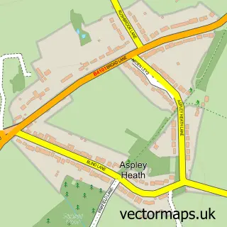
This Oldberrow street map is a detailed vector street map covering a 750m x 750m area. Select a larger area to create and download your own vector street map of Oldberrow.
The 750-metre map sample for Oldberrow covers 21 mapped buildings and approximately 12.0 km of road detail. The immediate area includes 1 GP surgery within 2 miles and 3 MOT stations within 2 miles. To create a larger or custom map of Oldberrow, the map builder lets you define your own coverage area and download editable SVG, PDF and PNG files.
Create a larger editable map of Oldberrow
Choose any area you need and generate a high-quality vector map instantly. Perfect for print, planning, design, business and personal use.

This Oldberrow street map in Warwickshire is available as downloadable SVG, PDF and PNG map files, or as a printed map for planning, business, display, education, local information and design work. You can also create a larger custom map area using the map selector.
What this Oldberrow map sample shows
Oldberrow lies within Oldberrow Cp parish, part of Studley With Mappleborough Green ward in the Stratford-On-Avon District local authority area. The postcode geography for this area includes the B postcode area, the B95 postcode district and the B95 5 postcode sector. Residents fall under the Nhs Coventry And Warwickshire Integrated Care Board for NHS services.
Local features near Oldberrow
Within 2 milesAmenities and services in and around Oldberrow.
Administrative and postcode information for Oldberrow
The local authority covering Oldberrow is Stratford-On-Avon District, within the county of Warwickshire. The settlement lies within Studley With Mappleborough Green ward and Oldberrow Cp civil parish. The B95 postcode district and B95 5 postcode sector serve the immediate area. NHS provision in the area is delivered through Worcestershire Acute Hospitals Nhs Trust.
Nearby street map samples around Oldberrow


More street maps in Warwickshire
750 metre map area coverage
Boundary, postcode and point of interest information for the 750m x 750m rectangle centred on this sample map.
Boundaries containing map centre
Constituency: Stratford-on-Avon Co Const
County: Warwickshire County
District: Stratford-on-Avon District
Icb: NHS Coventry and Warwickshire ICB
Parish: Oldberrow CP
Police Force: warwickshire
Postcode District: B95
Postcode Sector: B95 5
Ward: Wootton Wawen Ward
Nearby boundaries intersecting sample
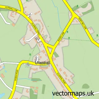
Parish: Ullenhall CP
Postcode coverage
POI category counts
Anglican Church: 1
Car Rental Agency: 1
Event Planning: 1
Retirement Home: 1
Software Development: 1
Sample points of interest
- Oldberrow - St. Mary
- Birmingham Car Finance
- Oldberrow House
- Home Instead Redditch & Bromsgrove
- Intrflex
Create a larger editable map of Oldberrow
This sample shows only a 750 metre area. To create a larger map of Oldberrow, use our map builder to choose your own coverage area, add titles and download editable SVG, PDF and PNG files.
Create a custom map of Oldberrow