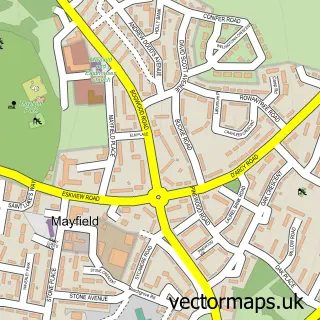
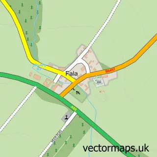
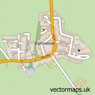
This Pathhead street map is a detailed vector street map covering a 750m x 750m area. Select a larger area to create and download your own vector street map of Pathhead.
The 750-metre map sample for Pathhead covers 243 mapped buildings and approximately 10.6 km of road detail, of which 13 named roads are named. The immediate area includes 1 GP surgery within 2 miles and 2 pubs. The wider area around Pathhead features 2 food and drink venues. To create a larger or custom map of Pathhead, the map builder lets you define your own coverage area and download editable SVG, PDF and PNG files.
Create a larger editable map of Pathhead
Choose any area you need and generate a high-quality vector map instantly. Perfect for print, planning, design, business and personal use.

This Pathhead street map in Midlothian is available as downloadable SVG, PDF and PNG map files, or as a printed map for planning, business, display, education, local information and design work. You can also create a larger custom map area using the map selector.
What this Pathhead map sample shows
Pathhead lies within Midlothian parish, part of Midlothian East ward in the Midlothian local authority area. The postcode geography for this area includes the EH postcode area, the EH37 postcode district and the EH37 5 postcode sector. Residents fall under the Lothian for NHS services.
Local features near Pathhead
Within 2 milesAmenities and services in and around Pathhead.
Administrative and postcode information for Pathhead
Pathhead lies within Midlothian parish, part of Midlothian East ward in the Midlothian local authority area. The postcode geography for this area includes the EH postcode area, the EH37 postcode district and the EH37 5 postcode sector. Residents fall under the Lothian for NHS services.
Nearby street map samples around Pathhead

More street maps in Midlothian
750 metre map area coverage
Boundary, postcode and point of interest information for the 750m x 750m rectangle centred on this sample map.
Boundaries containing map centre
Constituency: Midlothian Co Const
District: Midlothian
Icb: Lothian
Postcode District: EH37
Postcode Sector: EH37 5
Ward: Midlothian East Ward
Nearby boundaries intersecting sample
No additional intersecting boundaries found.
Postcode coverage
POI category counts
Bakery: 3
Sports Club And League: 3
Community Services Non Profits: 2
Korean Grocery Store: 2
Pub: 2
Arts And Entertainment: 1
Automation Services: 1
Bank Credit Union: 1
Bike Rentals: 1
Clothing Store: 1
Sample points of interest
- Pathhead Players
- Smart House Scotland
- A Wahlberg & Sons
- Albert Wahlberg & Sons Bakery
- Wahlberg
- RBS
- The Tartan Bicycle Company
- Little Boy Blue
- Pathhead and District Community Association
- Tynewater Parent Council
- Nicola Marr School of Motoring
- Help At Hand
Create a larger editable map of Pathhead
This sample shows only a 750 metre area. To create a larger map of Pathhead, use our map builder to choose your own coverage area, add titles and download editable SVG, PDF and PNG files.
Create a custom map of Pathhead