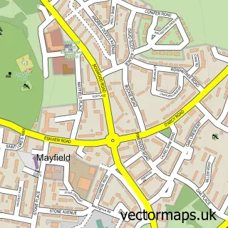
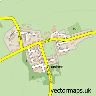
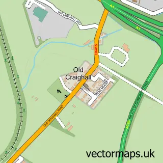
This Easthouses street map is a detailed vector street map covering a 750m x 750m area. Select a larger area to create and download your own vector street map of Easthouses.
The 750-metre map sample for Easthouses covers 296 mapped buildings and approximately 14.7 km of road detail, of which 23 named roads are named. The immediate area includes 2 GP surgeries within 2 miles and 1 MOT station, with 12 within 2 miles. The wider area around Easthouses features 1 tourism point of interest and 2 food and drink venues. To create a larger or custom map of Easthouses, the map builder lets you define your own coverage area and download editable SVG, PDF and PNG files.
Create a larger editable map of Easthouses
Choose any area you need and generate a high-quality vector map instantly. Perfect for print, planning, design, business and personal use.

This Easthouses street map in Midlothian is available as downloadable SVG, PDF and PNG map files, or as a printed map for planning, business, display, education, local information and design work. You can also create a larger custom map area using the map selector.
What this Easthouses map sample shows
Easthouses lies within Midlothian parish, part of Midlothian East ward in the Midlothian local authority area. The postcode geography for this area includes the EH postcode area, the EH22 postcode district and the EH22 5 postcode sector. Residents fall under the Lothian for NHS services.
Local features near Easthouses
Within 2 milesAmenities and services in and around Easthouses.
Administrative and postcode information for Easthouses
The local authority covering Easthouses is Midlothian, within the county of Midlothian. The settlement lies within Midlothian East ward and Midlothian civil parish. The EH22 postcode district and EH22 5 postcode sector serve the immediate area. NHS provision in the area is delivered through Lothian.
Nearby street map samples around Easthouses

More street maps in Midlothian
750 metre map area coverage
Boundary, postcode and point of interest information for the 750m x 750m rectangle centred on this sample map.
Boundaries containing map centre
Constituency: Midlothian Co Const
District: Midlothian
Icb: Lothian
Postcode District: EH22
Postcode Sector: EH22 4
Ward: Midlothian East Ward
Nearby boundaries intersecting sample
Postcode Sector: EH22 2, EH22 3, EH22 5
Postcode coverage
POI category counts
Automotive Repair: 2
Chinese Restaurant: 2
Coffee Shop: 2
Fast Food Restaurant: 2
Saw Mill: 2
Taxi Service: 2
Valet Service: 2
Acupuncture: 1
Arts And Crafts: 1
Auto Body Shop: 1
Sample points of interest
- Koha tuina
- Riccio Gallery
- Auto Paint Shop Ltd
- Lothian Valet
- Car iHouse Ltd.
- DLP Autos Dalkeith
- The Beauty Room
- Easthouses Boxing Club
- Mobile Munch Street food
- Midlothian Private Hire Taxis
- Balmoral Motor Company
- B & D Roofing & Building
Create a larger editable map of Easthouses
This sample shows only a 750 metre area. To create a larger map of Easthouses, use our map builder to choose your own coverage area, add titles and download editable SVG, PDF and PNG files.
Create a custom map of Easthouses