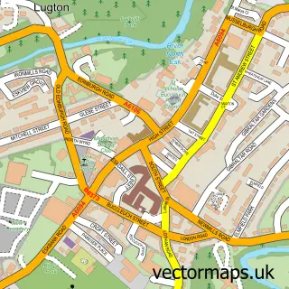
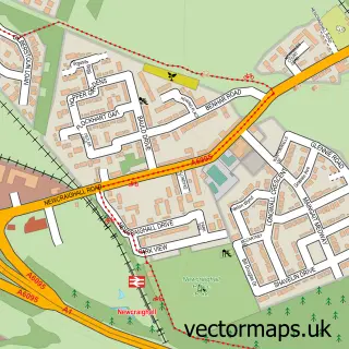
This Lugton street map is a detailed vector street map covering a 750m x 750m area. Select a larger area to create and download your own vector street map of Lugton.
The 750-metre map sample for Lugton covers 164 mapped buildings and approximately 9.5 km of road detail, of which 12 named roads are named. The immediate area includes 4 GP surgeries within 2 miles and 1 MOT station, with 11 within 2 miles. The wider area around Lugton features 1 hotel. To create a larger or custom map of Lugton, the map builder lets you define your own coverage area and download editable SVG, PDF and PNG files.
Create a larger editable map of Lugton
Choose any area you need and generate a high-quality vector map instantly. Perfect for print, planning, design, business and personal use.

This Lugton street map in Midlothian is available as downloadable SVG, PDF and PNG map files, or as a printed map for planning, business, display, education, local information and design work. You can also create a larger custom map area using the map selector.
What this Lugton map sample shows
Lugton lies within Midlothian parish, part of Dalkeith ward in the Midlothian local authority area. The postcode geography for this area includes the EH postcode area, the EH22 postcode district and the EH22 1 postcode sector. Residents fall under the Lothian for NHS services.
Local features near Lugton
Within 2 milesAmenities and services in and around Lugton.
Administrative and postcode information for Lugton
The local authority covering Lugton is Midlothian, within the county of Midlothian. The settlement lies within Dalkeith ward and Midlothian civil parish. The EH22 postcode district and EH22 1 postcode sector serve the immediate area. NHS provision in the area is delivered through Lothian.
Nearby street map samples around Lugton

More street maps in Midlothian
750 metre map area coverage
Boundary, postcode and point of interest information for the 750m x 750m rectangle centred on this sample map.
Boundaries containing map centre
Constituency: Midlothian Co Const
District: Midlothian
Icb: Lothian
Postcode District: EH22
Postcode Sector: EH22 1
Ward: Dalkeith Ward
Nearby boundaries intersecting sample
No additional intersecting boundaries found.
Postcode coverage
POI category counts
Building Supply Store: 3
Plumbing: 3
Professional Services: 2
Architect: 1
Architectural Designer: 1
Automotive Dealer: 1
Automotive Parts And Accessories: 1
Baptist Church: 1
Bowling Alley: 1
Business: 1
Sample points of interest
- Douglas Strachan Chartered Architect
- Alan Hardie Architecture: Architectural Consultant
- Edinburgh Sports Cars
- Eskside Motor Factors
- Dalkeith Baptist Church
- Dalkeith Bowling Club
- Charles Taylor Woodwork
- Quality Window Blinds & Blind Cleaning Services
- The Garden Doctor
- Sp2 Security Solutions Ltd
- Dalkeith Ford Centre
- Vocal
Create a larger editable map of Lugton
This sample shows only a 750 metre area. To create a larger map of Lugton, use our map builder to choose your own coverage area, add titles and download editable SVG, PDF and PNG files.
Create a custom map of Lugton